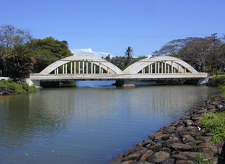
Haleʻiwa, Hawaii

Haleʻiwa (Hawaiian pronunciation: [həleˈʔivə]) is a North Shore community and census-designated place (CDP) in the Waialua District of the island of Oʻahu, City and County of Honolulu. Haleʻiwa is located on Waialua Bay, the mouth of Anahulu Stream (also known as Anahulu River). A small boat harbor is located here, and the shore of the bay is surrounded by Haleʻiwa Beach Park (north side) and Haleʻiwa Aliʻi Beach Park (south side). Further west from the center of town is Kaiaka State Recreation Area on Kiaka Point beside Kaiaka Bay. As of the 2020 census, the CDP had a population of 4,941. The 2018 estimate was 4,040. It is the largest commercial center on the North Shore of the island. Its old plantation town character is preserved in many of the buildings, making this a popular destination for tourists and residents alike, visiting surfing paddle boarding and diving sites along the north shore. The U.S. postal code for Haleʻiwa, including Kawailoa, is 96712.
Excerpt from the Wikipedia article Haleʻiwa, Hawaii (License: CC BY-SA 3.0, Authors, Images).Haleʻiwa, Hawaii
Pikai Street,
Geographical coordinates (GPS) Address Nearby Places Show on map
Geographical coordinates (GPS)
| Latitude | Longitude |
|---|---|
| N 21.59 ° | E -158.11388888889 ° |
Address
Pikai Street
Pikai Street
96712
Hawaii, United States
Open on Google Maps


