Greenbank, Bristol
Areas of Bristol

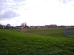
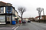
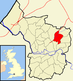
Greenbank is a small informal district in the city of Bristol, England nestling between Easton to the west, Eastville to the north-east, Clay Bottom and Rose Green to the east, and Whitehall to the south. The area is mainly one of 1890s terraced housing with some present millennium housing on the north eastern edge of the cemetery. Nearly all of the housing is in the north-east of Easton electoral ward, though the road Greenbank View and the cemetery are in Eastville electoral ward.
Excerpt from the Wikipedia article Greenbank, Bristol (License: CC BY-SA 3.0, Authors, Images).Greenbank, Bristol
Greenbank Road, Bristol Easton
Geographical coordinates (GPS) Address Nearby Places Show on map
Geographical coordinates (GPS)
| Latitude | Longitude |
|---|---|
| N 51.468 ° | E -2.557 ° |
Address
Greenbank Road 80
BS5 6HE Bristol, Easton
England, United Kingdom
Open on Google Maps


