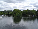
River Wye, Buckinghamshire
High WycombePapermaking in the United KingdomRivers of BuckinghamshireThames drainage basinUse British English from September 2017

The River Wye is a river in Buckinghamshire, England. Around 10.5 miles (16.9 km) in length, it rises close to West Wycombe village in the Chiltern Hills and flows through High Wycombe before emptying into the River Thames at Bourne End, on the reach above Cookham Lock. In particularly wet years, the source can temporarily change and effectively extend the river by another mile, due to a chalk spring rising above the ground in a field further up the same valley. High Wycombe takes part of its name from the river, which now runs mostly underground through the town. Pann Mill watermill, at the eastern end of Wycombe, is the last remaining watermill on the River Wye.
Excerpt from the Wikipedia article River Wye, Buckinghamshire (License: CC BY-SA 3.0, Authors, Images).River Wye, Buckinghamshire
Andrews Reach,
Geographical coordinates (GPS) Address Nearby Places Show on map
Geographical coordinates (GPS)
| Latitude | Longitude |
|---|---|
| N 51.570277777778 ° | E -0.71111111111111 ° |
Address
Andrews Reach
Andrews Reach
SL8 5DP , Wooburn
England, United Kingdom
Open on Google Maps


