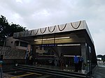
INA Colony

INA colony is a residential colony maintained by the Airports Authority of India for their employees. It was named after a former private airline, Indian National Airways, which was amongst those nationalised and merged to form, Indian Airlines in 1953. Situated on Aurobindo Marg, across Dilli Haat and behind INA Market, the colony lies near Safdarjung Airport, on Sri Aurobindo Marg, Kotla Mubarakpur opposite to Laxmibai Nagar adjacent to Kidwai Nagar East. The INA market also has shops selling varieties of imported foodstuff and wines for expatriates due to its proximity to Chanakyapuri diplomatic enclave. Starting 2010, it is serviced by the Dilli Haat - INA underground station of the Delhi Metro. INA market is also famous for its Sea Food items.
Excerpt from the Wikipedia article INA Colony (License: CC BY-SA 3.0, Authors, Images).INA Colony
Aurobindo Marg, New Delhi
Geographical coordinates (GPS) Address Nearby Places Show on map
Geographical coordinates (GPS)
| Latitude | Longitude |
|---|---|
| N 28.5756 ° | E 77.2097 ° |
Address
Kidwai Nagar
Aurobindo Marg
110029 New Delhi (Vasant Vihar Tehsil)
Delhi, India
Open on Google Maps


