place

West Carson, California

Census-designated places in CaliforniaCensus-designated places in Los Angeles County, CaliforniaLos Angeles Harbor RegionSouth Bay, Los AngelesUse mdy dates from July 2023
LA County Incorporated Areas West Carson highlighted

West Carson is an unincorporated community in the South Bay region of Los Angeles County, California. The population was 22,870 at the 2020 census. For statistical purposes, the United States Census Bureau has defined West Carson as a census-designated place (CDP).

Excerpt from the Wikipedia article West Carson, California (License: CC BY-SA 3.0, Authors, Images).

West Carson, California
West Jay Street,

Geographical coordinates (GPS) Address Nearby Places
placeShow on map

Wikipedia: West Carson, CaliforniaContinue reading on Wikipedia

Geographical coordinates (GPS)

Latitude Longitude
N 33.826388888889 ° E -118.2925 °
placeShow on map

Address

West Jay Street 1001
90502 , West Carson
California, United States
mapOpen on Google Maps

LA County Incorporated Areas West Carson highlighted
Share experience

Nearby Places

Pacific Electric Railroad Bridge

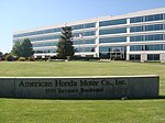
The Pacific Electric Railroad Bridge or Southern Pacific Railroad Bridge now officially named the "Pacific Electric Railway- El Prado Bridge" is a historic double-tracked arch bridge located in Torrance, California USA, spanning Torrance Boulevard at Bow Avenue, a short distance west of Western Avenue. It was once part of the north/south San Pedro via Gardena Line of the Pacific Electric Railway, that agency's first interurban line to San Pedro.Torrance, California is a town that was planned on the drawing board. Before 1912 there was no settlement in the area. After splitting off to the east from the Union Tool Company plant which was once a short distance south of the bridge, the line terminated at the new Torrance plant of the Llewellyn Iron Works which was opened in 1916 (and was since 1923 for most of its life a Columbia Steel Company plant). It ran up and over the railroad's east/west Torrance local line in much the same manner as a viaduct and is the only part of the PE which crossed itself in such a manner; indeed, the map on the following reference link refers to the bridge as a viaduct. This was due to the area's geography; simply building a spur off of the main line would have resulted in too steep a climb to the steel mill. The steel mill has since been demolished to make way for the national headquarters of American Honda Motor Company, but the once double-tracked Torrance line was reballasted and rerailed with used welded rail in 2003 and is still in use for local runs by the Union Pacific Railroad. Gone too are the Pacific Electric's Torrance shops at the western branch of the split, now the site of an industrial park still serviced by the aforementioned local line. Designed by Irving Gill and built in 1913 as part of the original layout of the city as determined by Jared Sidney Torrance and Frederick Law Olmsted Jr., the bridge became the city's second entry in the National Register of Historic Places on July 13, 1989 after Torrance High School. It is also listed with the California Office of Historic Preservation.The Pacific Electric Railway- El Prado Bridge, was dedicated as a Local Engineering Landmark by the American Society of Civil Engineers in 2013. Though trackage, turnouts and remnants of a switch remain on the bridge, it is no longer in use nor has it been for quite some time. There is no chance of the bridge returning to service, since the right-of-way at either end has been redeveloped. Nevertheless, the Pacific Electric Railroad Bridge has become a symbol of the city as part of the Torrance Police Department's logo as of January 1, 2000, only the third such change in the department's history.