Harbor Gateway, Los Angeles

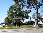
The Harbor Gateway is a 5.14-square-mile residential and industrial area (13.3 km2) in the South Bay and Los Angeles Harbor Region, in the southern part of the city. The neighborhood is narrow and long, running along a north-south axis. Its unusual shape has given it the alternative name of "the Shoestring Strip". The northern limit of the neighborhood is Imperial Highway, a city street just north of I-105. Harbor Gateway was attached to Los Angeles in 1906 to serve as a link to the Pacific Ocean port cities of Wilmington and San Pedro. It was given its present name in 1985. With a relatively youthful and ethnically diverse population of over 42,000, the center of the community is anchored by Gardena High School. The neighborhood is bisected by Artesia Boulevard and has two neighborhood councils, one north of the boulevard and the other south of it. A large transportation center serves the south Los Angeles County area.
Excerpt from the Wikipedia article Harbor Gateway, Los Angeles (License: CC BY-SA 3.0, Authors, Images).Harbor Gateway, Los Angeles
Francisco Street,
Geographical coordinates (GPS) Address Nearby Places Show on map
Geographical coordinates (GPS)
| Latitude | Longitude |
|---|---|
| N 33.850072 ° | E -118.299068 ° |
Address
Francisco Street
90502 , Harbor Gateway
California, United States
Open on Google Maps


