Pulham
Civil parishes in DorsetDorset geography stubsNorth Dorset DistrictVillages in Dorset

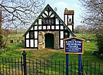
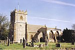
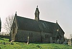
Pulham is a village and civil parish in the county of Dorset in south-west England. It is situated in the Blackmore Vale, 7 miles (11 kilometres) southeast of Sherborne. In the 2011 Census the civil parish had 105 dwellings, 103 households and a population of 269.Pulham was mentioned in the Domesday Book of 1086, and was once owned by Cirencester Abbey, a connection remembered in the name of Cannings Court Farm (the "Court of the Canons"). Priests from nearby Milton Abbey also used to visit the village church; they resided above the porch in a priests' room, accessed via a staircase within the wall.
Excerpt from the Wikipedia article Pulham (License: CC BY-SA 3.0, Authors, Images).Pulham
B3143,
Geographical coordinates (GPS) Address Nearby Places Show on map
Geographical coordinates (GPS)
| Latitude | Longitude |
|---|---|
| N 50.8765 ° | E -2.4179 ° |
Address
B3143
DT2 7FL , Pulham
England, United Kingdom
Open on Google Maps


