place

Holwell, Dorset

Dorset geography stubsPlaces formerly in SomersetVillages in Dorset
Holwell Village geograph.org.uk 380093

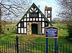
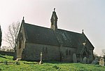
Holwell is a village and civil parish in the county of Dorset in southern England, situated approximately 5 miles (8.0 km) south-east of Sherborne. It is sited on Oxford clay in the Blackmore Vale. Its name derives from the Old English hol and walu, meaning a bank or ridge in a hollow. The parish includes the hamlets of Sandhills, Westrow, Barnes Cross, The Borough, and Woodbridge. In the 2011 census the parish had a population of 369 and is part of the Cam Vale electoral ward. Until 1844 Holwell was an exclave of Somerset, being part of the parish of Milborne Port.Holwell parish church is situated with a few houses at the end of a cul-de-sac in a small settlement called The Borough. This is the original medieval part of the village, sited next to the Caundle Brook in the north of the parish. Secondary settlements were established later to the south, east and west; these were outside The Borough's open field system and had their own enclosures. The most southerly part of the parish was enclosed in 1797. The church, dedicated to St Lawrence, largely dates from the late 15th century, though it was restored in 1885. The biblical scholar Henry Adeney Redpath was rector at Holwell between 1883 and 1890.A short distance north of the church the Caundle Brook is crossed by a packhorse bridge, probably of medieval origin. About 0.5 miles (0.80 km) to the west and also crossing the Caundle Brook is Cornford Bridge, dating from the 15th and 18th centuries and designated a grade II* listed building and a scheduled monument. Also grade II* listed is Naish Farm, situated approximately 0.5 miles (0.80 km) southeast of The Borough and a good example of a medieval domestic farmhouse. At Barnes Cross—between The Borough and Cornford Bridge—is a pillar box which is the oldest still in everyday use in Britain. It is hexagonal with a vertical letter slot and was made between 1853 and 1856 by the Gloucester firm John N. Butt & Co. It is also grade II* listed.

Excerpt from the Wikipedia article Holwell, Dorset (License: CC BY-SA 3.0, Authors, Images).

Holwell, Dorset
Fosters Hill,

Geographical coordinates (GPS) Address Nearby Places
placeShow on map

Wikipedia: Holwell, DorsetContinue reading on Wikipedia

Geographical coordinates (GPS)

Latitude Longitude
N 50.896 ° E -2.424 °
placeShow on map

Address

Fosters Hill

Fosters Hill
DT9 5LL , Holwell
England, United Kingdom
mapOpen on Google Maps

Holwell Village geograph.org.uk 380093
Share experience

Nearby Places

Stourton Caundle
Stourton Caundle

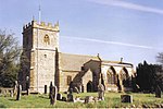
Stourton Caundle is a village and civil parish in the county of Dorset in southwest England. It lies within the Blackmore Vale, about five miles (eight kilometres) east of Sherborne. In the 2011 census the parish had 181 households and a population of 439.Stourton Caundle is one of several settlements in the area to bear the name "Caundle", the others being Bishop's Caundle, Purse Caundle and Caundle Marsh. The origin of "Caundle" is uncertain. In the Domesday Book in 1086 there are seven Domesday entries connected to the village, recorded as "Candelle", "Candel" or "Candele" in the hundred of Brunsell. The entries record a total of 45 households and a total taxable value of 17 geld units. Sir Henry de Haddon, a lord from Northamptonshire, bought land and founded a manor here in 1202, and the resultant settlement was called "Caundel Haddon" or "Caundle Haddon". The Haddons retained the manor until 1461 when it passed to the Stourton family, which resulted in the current village name.The manor was on the west side of the main village street and was probably fortified, resulting in it being referred to as a 'castle', though only a thirteenth-century chapel building (no longer used as such) and two fish ponds associated with the site now remain.Stourton Caundle's parish church is dedicated to St Peter and has a thirteenth-century nave and chancel, and a fourteenth-century tower.The village was once a venue for stave dancing.The village has a small pub called The Trooper, but villagers must travel to local town Stalbridge for other amenities. Enid Blyton used Manor Farm as inspiration for her novel Five on Finniston Farm. She owned the farm for a short time in the late 1950s.

Glanvilles Wootton
Glanvilles Wootton

Glanvilles Wootton, or Wootton Glanville, is a village and civil parish in the county of Dorset in southern England. It is situated in the Blackmore Vale under the scarp of the Dorset Downs, five miles (eight kilometres) south of Sherborne. In the 2011 Census the parish had a population of 196.To the north of the village is Round Chimneys Farm, which used to be a manor house and home of John Churchill, 1st Duke of Marlborough. The Farm, Grade II listed since 1960, "originated c.1590s, probably added to 1632 with extensive alterations and demolitions C19". One mile (1.5 kilometres) southeast of the village is the hill fort Dungeon Hill. According to Dorset OPC, "the name of the Parish was changed in 1985, having previously been Wootton Glanville". The Parish Church is St Mary the Virgin and its register starts at the year 1546. It has been Grade I listed since 1964 as "mainly C14" modifications made in the 15th century and the early 19th century. A great deal of additional historic information about the community and its structures is provided by a document titled An Inventory of the Historical Monuments in Dorset, Volume 3, Central. Originally published by Her Majesty's Stationery Office, London, 1970.One of the most significant properties in the area, The Manor House, Glanvilles Wootton, is a Georgian manor house, which incorporates an earlier 17th-century house, on 88 acres of parks, pastures and gardens, according to Country Life (magazine). The original house is believed to have been built circa 1616 by George Williams, originally from Wales; the newer Georgian home was built in 1804 by Glanvilles Wootton.The "MANOR HOUSE FARMHOUSE WOOTTON GLANVILLES FARM" has been Grade-II listed since 1974. The farm house appears to have originated in the mid 1800s but was modified circa 1978.

Mappowder
Mappowder

Mappowder is a village and civil parish in the county of Dorset in southern England. The parish lies approximately 9 miles (14 kilometres) southeast of the town of Sherborne and covers about 1,900 acres (770 hectares) at an elevation of 75 to 160 metres (250 to 520 feet). It is sited on Corallian limestone soil at the southern edge of the Blackmore Vale, close to the northern scarp face of the Dorset Downs. In the 2011 census the parish had 71 dwellings, 69 households and a population of 166.The village name comes from mapuldor, Old English for 'maple tree'. In 1086 in the Domesday Book Mappowder was recorded as Mapledre and appears in four entries; it was in Buckland Newton Hundred, had 33.3 households and a total taxable value of 8.3 geld units.The church, dedicated to St Peter & St Paul, is Perpendicular and was built in the late 15th and 16th centuries. However, it includes features remaining from an earlier 12th-century church. The chancel was extended in 1868 by the Wingfield Digby family of Sherborne Castle, who owned the village in Victorian times. Mappowder was once the home of the Coker family, who built a large mansion here in 1654, although this was pulled down in the mid-eighteenth century. The building which occupies the site now, Mappowder Court, is mostly of mid-eighteenth-century origin, with some earlier remnants. The stone gateposts at the entrance remain from the original Coker manor; these are topped by carved human heads which in 1905 Sir Frederick Treves described as "Blackamore's" these being "those indefinite natives of the tropics having been used for the crest of the Coker family." In 1559 Henry Coker (c.1528–1596) was member of parliament for the constituency of Shaftesbury. Mappowder Court is listed by English Heritage as Grade II*, with the gateposts and courtyard walls as Grade II.Novelist and short story writer Theodore Francis Powys lived in Mappowder for the last 13 years of his life; he died and was buried here in 1953.