place

Lydlinch

Civil parishes in DorsetDorset geography stubsVillages in Dorset
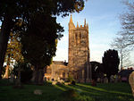
St Thomas a Becket Church Lydlinch geograph.org.uk 379977

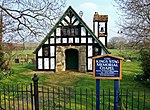
Lydlinch is a village and civil parish in the Blackmore Vale in north Dorset, England, about three miles (five kilometres) west of Sturminster Newton. The village is sited on Oxford clay close to the small River Lydden. The parish – which includes the village of King's Stag to the south and the hamlet of Stock Gaylard to the west – is bounded by the Lydden to the east and its tributary, the Caundle Brook, to the north. The 2011 census recorded the parish as having 199 dwellings, 192 households and a population of 437.At King's Stag is the King's Stag Memorial Chapel which was built in 1914 at the expense of the Right Rev. Huyshe Yeatman-Biggs, the Bishop of Worcester, in memory of his wife, Lady Barbara Yeatman-Biggs, who died in 1909.

Excerpt from the Wikipedia article Lydlinch (License: CC BY-SA 3.0, Authors, Images).

Lydlinch
Holebrook Lane,

Geographical coordinates (GPS) Address Nearby Places
placeShow on map

Wikipedia: LydlinchContinue reading on Wikipedia

Geographical coordinates (GPS)

Latitude Longitude
N 50.9204 ° E -2.3665 °
placeShow on map

Address

Holebrook Lane

Holebrook Lane
DT10 2JA , Lydlinch
England, United Kingdom
mapOpen on Google Maps

St Thomas a Becket Church Lydlinch geograph.org.uk 379977
Share experience

Nearby Places

Hazelbury Bryan
Hazelbury Bryan

Hazelbury Bryan is a village and civil parish in the county of Dorset in southern England. It is situated in the Blackmore Vale, approximately five miles (eight kilometres) southwest of the small town of Sturminster Newton. The parish includes the hamlets of Droop, Kingston, Parkgate, Pidney, Pleck, Wonston and Woodrow. In the 2011 census the parish had 480 dwellings, 454 households and a population of 1,059.In 1201 the village name was spelled Hasebere. The name is derived from the Old English hæsel and bearu, meaning a hazel grove or wood, plus the manorial name of the Bryene or de Bryan family; Sir Guy de Bryan, of Woodsford Castle, gave his surname to the village in the 14th century when he married the daughter of the First Earl of Salisbury.The original settlement in the village is the hamlet of Droop, which is the location of the parish church. The church dates mostly from the 15th century, though it is perhaps the third building to have existed on the site. The other hamlets in the village are believed to have originated as a result of the Black Death twice afflicting the original settlement, and the villagers responding by burning it and rebuilding several smaller settlements on higher ground nearby.The geology of the parish consists of Oxford clay in the northwest, a band of Corallian limestone and sand running from southwest to northeast, and Kimmeridge clay in the southeast. Drainage consists of several small streams flowing northwest and north into the River Lydden and northeast into the River Stour.Hazelbury Bryan civil parish is the most populous parish within the electoral ward of Lydden Vale, which extends from Fifehead Neville parish in the north to Mappowder in the south and Glanvilles Wootton in the west. The population of the ward at the 2011 census was 1,967.

Stourton Caundle
Stourton Caundle

Stourton Caundle is a village and civil parish in the county of Dorset in southwest England. It lies within the Blackmore Vale, about five miles (eight kilometres) east of Sherborne. In the 2011 census the parish had 181 households and a population of 439.Stourton Caundle is one of several settlements in the area to bear the name "Caundle", the others being Bishop's Caundle, Purse Caundle and Caundle Marsh. The origin of "Caundle" is uncertain. In the Domesday Book in 1086 there are seven Domesday entries connected to the village, recorded as "Candelle", "Candel" or "Candele" in the hundred of Brunsell. The entries record a total of 45 households and a total taxable value of 17 geld units. Sir Henry de Haddon, a lord from Northamptonshire, bought land and founded a manor here in 1202, and the resultant settlement was called "Caundel Haddon" or "Caundle Haddon". The Haddons retained the manor until 1461 when it passed to the Stourton family, which resulted in the current village name.The manor was on the west side of the main village street and was probably fortified, resulting in it being referred to as a 'castle', though only a thirteenth-century chapel building (no longer used as such) and two fish ponds associated with the site now remain.Stourton Caundle's parish church is dedicated to St Peter and has a thirteenth-century nave and chancel, and a fourteenth-century tower.The village was once a venue for stave dancing.The village has a small pub called The Trooper, but villagers must travel to local town Stalbridge for other amenities. Enid Blyton used Manor Farm as inspiration for her novel Five on Finniston Farm. She owned the farm for a short time in the late 1950s.