Sturminster Marshall

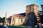
Sturminster Marshall is a village and civil parish in the east of Dorset in England, situated on the River Stour between Blandford Forum and Poole. The parish had a population of 1,895 at the 2001 census, increasing to 1,969 at the 2011 Census and includes the village of Almer (50.78°N 2.12°W / 50.78; -2.12) west of Sturminster Marshall, near Winterborne Zelston and the hamlet of Henbury to the south-east of the village. The village is twinned with the French commune of Sainte-Mère-Église in Normandy. The appropriate electoral ward is called 'Stour'. From Sturminster Marshall the ward goes east to Pamphill, with a total population of 2,582.King Alfred the Great, in his will of 899, a copy of which can be seen at the British Library, left the village to his youngest son Æthelweard (c.880-922). Sturminster Marshall has a 13th century church, St. Mary's. Its predecessor contributed to the village's name; 'Sturminster' meaning "church on the River Stour". The second part of the name came from William Marshall. Until 1857, St. Hubert's Church in Corfe Mullen acted as a chapel of ease to Sturminster Marshall. St. Mary's pre-reformation chalice, dating to 1536, has survived although the stem has been replaced. It is on loan to Dorset County Museum.
Excerpt from the Wikipedia article Sturminster Marshall (License: CC BY-SA 3.0, Authors, Images).Sturminster Marshall
Churchill Close,
Geographical coordinates (GPS) Address Nearby Places Show on map
Geographical coordinates (GPS)
| Latitude | Longitude |
|---|---|
| N 50.7973 ° | E -2.0747 ° |
Address
Churchill Close
Churchill Close
BH21 4BQ , Sturminster Marshall
England, United Kingdom
Open on Google Maps


