place

Shapwick, Dorset

Civil parishes in DorsetDorset geography stubsUse British English from September 2017Villages in Dorset
Shapwick, Dorset geograph.org.uk 1061168

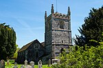
Shapwick is a village and civil parish in east Dorset, England, situated on the River Stour five miles south-east of Blandford Forum and eight miles north of Poole. The village had a population of 190 in 2001. Within the parish, about a mile to the north-east of the village, is the Iron Age hill fort of Badbury Rings.In Roman times there was a Roman Fort at Crab Farm, between Shapwick and Badbury Rings. Just to the west of the fort was a small Romano-British town, believed to be that listed in the Antonine Itinerary as Vindocladia.Shapwick lay on the important Roman Road from Old Sarum to Durnovaria. The river Stour was forded here. House numbers above 200 in the High Street contrast with the smaller number of houses there at present. As the village declined, burnt down thatched cottages were not replaced. In 1983 Shapwick was used as one of the two real life locations for the Doctor Who story The Awakening. The other village used was Martin in Hampshire. One of its most famous residents was Charles Bennett who won the 1500 metres at the 1900 Summer Olympics.

Excerpt from the Wikipedia article Shapwick, Dorset (License: CC BY-SA 3.0, Authors, Images).

Shapwick, Dorset
High Street,

Geographical coordinates (GPS) Address Nearby Places
placeShow on map

Wikipedia: Shapwick, DorsetContinue reading on Wikipedia

Geographical coordinates (GPS)

Latitude Longitude
N 50.8175 ° E -2.0879 °
placeShow on map

Address

High Street 206
DT11 9JT , Shapwick
England, United Kingdom
mapOpen on Google Maps

Shapwick, Dorset geograph.org.uk 1061168
Share experience

Nearby Places

St Mary the Virgin, Tarrant Crawford

The Church of St Mary the Virgin in Tarrant Crawford, Dorset, England, was built in the 12th century. It is recorded in the National Heritage List for England as a designated Grade I listed building, and is now a redundant church in the care of the Churches Conservation Trust. It was vested in the Trust on 1 July 1988.The church is all that remains of Tarrant Abbey, for which it may have been a lay church. The Abbey was founded in the 13th century by Ralph de Kahaines (of nearby Tarrant Keyneston) as a Cistercian nunnery. The flint chancel, dates from the 12th century, with the nave, tower and porch being built in the 14th century. The 15th-century tower houses three bells, two of them medieval and one 17th century. The nave roof added in the early 16th century. In 1911 a major restoration of the church was undertaken. The interior includes several coffin lids from the 13th century. These have been moved from the Abbey and may relate to two of the famous people associated with it. The first is Queen Joan, the wife of Alexander II of Scotland and daughter of King John of England (Richard I's brother and successor) who is buried in the grave yard (supposedly in a golden coffin). The second is Bishop Richard Poore, builder of Salisbury Cathedral, who was baptised in the abbey church and later (in 1237) buried in the abbey, which he founded. He was at one time Dean of the old cathedral at Old Sarum, and later became bishop of first Chichester, then Salisbury and finally Durham.There are also 15th century stained glass, a font from the 16th century and an octagonal pulpit pews with moulded panelling from the 17th century. Mediaeval wall paintings cover most of the walls of the nave and chancel, dating from the 13th and 14th centuries. One set of pictures depicts the acts of St Margaret of Antioch. The Annunciation dates from the 14th century and shows the winged figure of Gabriel and the virgin. The south wall has two rows of paintings one above the other. The lower set show three kings or princes, and three skeletons, which are believed to represent "the emptiness of earthly rank and riches".Attendance at the church fell after World War II and it was declared redundant becoming the responsibility of the Churches Conservation Trust in 1988. £100,000 was spent on masonry repairs and make it weather-proof. Another £68,000 was spent between 2003 and 2007 to improve the drainage, eradicate death watch beetle and stabilise and re-roof the tower.

River Tarrant
River Tarrant

The River Tarrant is a 12 km long tributary of the River Stour in Dorset. The valley lies to the east of Blandford Forum. The river rises near Cranborne Chase, an area of chalk downland, and flows broadly from north to south before joining the river Stour. The eight Tarrant Valley villages/hamlets all bear the name of the river. Listed in order from the river's source they are: Tarrant Gunville: the source of the river is in the grounds of Gunville House, now demolished. The parish church is dedicated to St Mary. Tarrant Hinton: a village at a crossroads. The parish church is dedicated to St Mary. Tarrant Launceston: a hamlet with a 17th-century three-arched bridge. The church, dedicated to St Mary, was demolished in the 1700s (the site is on Higher Dairy Farm). Now part of the parish of Tarrant Monkton. Tarrant Monkton: a village with a parish church dedicated to All Saints. Tarrant Rawston: a very small settlement. This once had a parish church dedicated to St Mary, which still exists and is in private ownership but remains as a church. Tarrant Rushton: a village with a parish church dedicated to St Mary. Near here was a World War II RAF airfield. Tarrant Keyneston: this is the largest village of the eight; it has a parish church dedicated to All Saints. Tarrant Crawford, the final settlement, lies at the confluence of the rivers Tarrant and Stour. Here there is the church of St Mary the Virgin held by the Churches Conservation Trust and Tarrant Abbey farm, where once stood a nunnery. Tarrant Crawford became part of the parish of Tarrant Keyneston.There were possibly one or two other Tarrant communities: Tarrant Stubhampton, north of Tarrant Gunville and part of that parish: This is now known as Stubhampton. In the Middle Ages, a church existed in that village. This is the source of the Tarrant. Tarrant Antioch which may have been an earlier name for Tarrant Rawston, or may have been a distinct community just north of Tarrant Rawston. Tarrant Antioch was served by St Mary Tarrant Crawford, where there was a devotion to St Margaret of Antioch. Tarrant Preston, now Preston FarmA Roman road followed the valley and there are many tumuli on the hills on both sides of the river, evidence of long occupation.

Spetisbury railway station

Spetisbury railway station was a station in the English county of Dorset. It was located between Blandford Forum and Bailey Gate on the Somerset and Dorset Joint Railway. The station consisted of two platforms, a station building, signal box and shelters. The ‘down’ platform is the station's original platform, which opened with timber booking office and waiting rooms on 1 November 1860. The platform was extended and a separate brick-built ladies’ waiting room was provided in 1888. The concrete floor and fireplace you see today is the foundation of this building. During reconstruction of the station around 1900 when double track was laid, this platform was again extended to a total length of 300 ft. It then became the ‘down’ platform for trains to Bailey Gate, Broadstone, Poole and Bournemouth (West). You can clearly see the different methods of construction where this platform has been extended.The ‘up’ platform is 300 ft long and was built during reconstruction of the station around 1900. It was used for trains to Blandford, Templecombe, Evercreech Junction (change for the Burnham-on-Sea branch) and Bath (Green Park). This platform opened on 29 April 1901 and was provided with a brick station building containing a booking office, waiting rooms and lavatories. The rear wall of this building still survives as it holds back the field behind the station. The foundations of the various rooms with the three fireplaces can still be seen today.