Arley, Cheshire
Cheshire geography stubsVillages in Cheshire

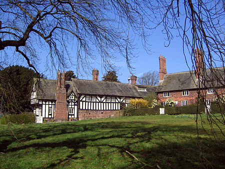
Arley is a small village in the civil parish of Aston by Budworth, Cheshire, England, adjacent to Arley Hall. 0.7 miles (1.1 km) to the east is a small group of houses known as Arley Green. The village is 3.8 miles (6.1 km) south of Lymm and 5 miles (8.0 km) north of Northwich. The buildings now comprising Arley Green originally formed Cowhouse Farm. Rowland Egerton-Warburton converted the half-timbered barn into a school and adapted another 18th-century building into a terrace of Tudor-style buildings. The farmhouse was converted into a parsonage.
Excerpt from the Wikipedia article Arley, Cheshire (License: CC BY-SA 3.0, Authors, Images).Arley, Cheshire
Arley Road,
Geographical coordinates (GPS) Address Nearby Places Show on map
Geographical coordinates (GPS)
| Latitude | Longitude |
|---|---|
| N 53.324 ° | E -2.496 ° |
Address
Arley, Arley Road / Old Post Office
Arley Road
CW9 6NS , Aston by Budworth
England, United Kingdom
Open on Google Maps


