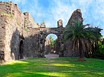
Naigaon
Naigaon is an area under Vasai Taluk in the Vasai Virar Belt that is separated by the Vasai Creek from Mira-Bhayandar, Thane and Mumbai city. It is linked by the Versova Bridge /Ghodbunder Bridge to Navghar village, which is connected from the east side of the settlement by the National Highway and it is the First Settlement in Vasai Virar after crossing the Vasai Creek. Naigaon in the eastern side is well connected to NH 48 / WEH. Juchandra & Kaman Road are the railway stations in Naigaon east that connects Vasai Road railway station in the north & Diva Jn. & Panvel Jn. Rail Stations in the south. The construction work of Naigaon flyover is in progress to connect Naigaon east & west which will reduce the travel time & also save fuel.
Excerpt from the Wikipedia article Naigaon (License: CC BY-SA 3.0, Authors).Naigaon
Naigaon FOB, Vasai-Virar
Geographical coordinates (GPS) Address Nearby Places Show on map
Geographical coordinates (GPS)
| Latitude | Longitude |
|---|---|
| N 19.351467 ° | E 72.846343 ° |
Address
Naigaon
Naigaon FOB
401207 Vasai-Virar
Maharashtra, India
Open on Google Maps


