place

Kalvebod Fælled

AmagerCapital Region of Denmark stubsGeography of CopenhagenLand reclamationParks in Copenhagen
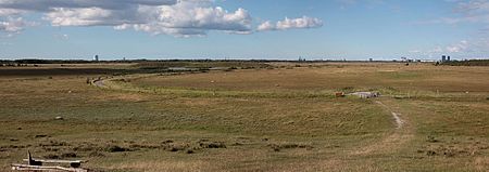
Kalvebod panoramic
Kalvebod panoramic

Kalvebod Fælled ("Kalvebod Commons"), also known as Vestamager ("Western Amager"), takes up roughly one fourth of the island of Amager near Copenhagen, Denmark. The area consists of reclaimed sea bed, with a number of former islets making up small isolated hills; it was dammed and drained during the 1940s to serve as an artillery training range. After active military use ended in 1983, some of the area has been used for transportation infrastructure (motorway and railway in connection with the Øresund bridge), a landfill on the strip between the motorway and the ocean dyke, a golf course and the southern end of the Ørestad urban development. Most of the area, however, lies as lightly maintained parkland featuring a range of nature types, from young forests to tidal marshes; some areas are prevented from developing into forests by grazing livestock and game. After years of preparation the area was finally cleared of unexploded munitions and fully opened to the general public on October 15, 2010. Previously, because of the risk of unexploded munitions, walking outside the paths and roads was generally not allowed. A large area in the southwestern corner is set aside under the Natura 2000-scheme as an EU-recognized bird protection area to which the general public has no access.

Excerpt from the Wikipedia article Kalvebod Fælled (License: CC BY-SA 3.0, Authors, Images).

Kalvebod Fælled
Svenskeholmvej, Tårnby Kommune

Geographical coordinates (GPS) Address Nearby Places
placeShow on map

Wikipedia: Kalvebod FælledContinue reading on Wikipedia

Geographical coordinates (GPS)

Latitude Longitude
N 55.6 ° E 12.55 °
placeShow on map

Address

Svenskeholmvej

Svenskeholmvej
2450 Tårnby Kommune
Capital Region of Denmark, Denmark
mapOpen on Google Maps

Kalvebod panoramic
Kalvebod panoramic
Share experience

Nearby Places

Ørestad
Ørestad

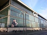
Ørestad (Danish pronunciation: [ˈøːɐˌstæð]) is a developing city area in Copenhagen, Denmark, on the island of Amager. The area was developed using the new town concept, closely linked with the M1 line of the Copenhagen Metro. Economically, income for the plan would be generated by selling the public-owned, unused land for development, thus financing the construction of the metro, and contrarily, metro access was deemed necessary for making development attractive. While the metro is the primary public transport access, the area is also served by the Øresund Line between Copenhagen and Malmö, the motorway E20 and close to Copenhagen Airport. Ørestad was originally planned to consist of four districts, however only three are developed: Ørestad Nord, the unbuilt Amager Fælled area (which will remain a nature reserve), Ørestad City and Ørestad Syd. Therefore, Ørestad in reality consists of two areas detached from each other. The northernmost Ørestad Nord area is coherent with inner Copenhagen. Many Copenhageners will often only regard the outlying area, the two southern districts around Ørestad Station and Field's shopping centre, as Ørestad proper. Ørestad is neighbouring the nature areas of Amager Common and Vestamager which consist mainly of land reclaimed in the first half of the 20th century, with wetlands, bushes and self-grown small woods. These recreational areas, as well as Ørestad itself and the surrounding island, are almost entirely flat. Some notable institutions in Ørestad are the DR Village (headquarters of the national Danish broadcaster DR), Copenhagen Concert Hall designed by Jean Nouvel, Field's (the largest shopping mall in Denmark), Bella Center (the largest exhibition and conference center in Scandinavia) and Bella Sky Hotel, the largest hotel in Scandinavia. Of these, Bella Center existed before the concept of Ørestad.