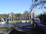
Teddington Lock

Teddington Lock is a complex of three locks and a weir on the River Thames between Ham and Teddington in the London Borough of Richmond upon Thames, England. Historically in Middlesex, it was first built in 1810. The limit of legal powers between the Port of London Authority, the navigation authority downstream to the North Sea and that upstream to small headwaters of the river, the Environment Agency, is marked nearby by an obelisk on the "Surrey" (towpath, right) bank. The weir named Teddington Weir marks the river's usual tidal limit and is the lowest on the Thames. This lock is the lowest full-tide lock and second lowest of all-tide locks on the Thames. The complex of civil engineering or infrastructure in essence consists of a large long weir and three locks: a conventional launch lock in regular use, very large barge lock and a small skiff lock. The barge lock was made to accommodate long barges, steamers or passenger ferries and has an additional set of gates half-way to operate more quickly for shorter craft. The staggered structures incorporate two reinforced narrow islands. The upper island is traversed by and accessible by the lock gates or Teddington Lock Footbridge.
Excerpt from the Wikipedia article Teddington Lock (License: CC BY-SA 3.0, Authors, Images).Teddington Lock
Manor Road, London Ham (London Borough of Richmond upon Thames)
Geographical coordinates (GPS) Address Nearby Places Show on map
Geographical coordinates (GPS)
| Latitude | Longitude |
|---|---|
| N 51.431666666667 ° | E -0.32388888888889 ° |
Address
Manor Road
TW11 8BF London, Ham (London Borough of Richmond upon Thames)
England, United Kingdom
Open on Google Maps


