place

Cowcliffe

Areas of Huddersfield
Cowcliffe Hill Road viewed from Brayside Avenue geograph.org.uk 1432846

Cowcliffe is an area of Huddersfield, West Yorkshire, England. It is situated between Fixby and Birkby based around Cowcliffe Hill Road. Cowcliffe is a discernible village, though the boundaries are not clear and is somewhat isolated from the rest of Huddersfield – only two buses an hour go through the area, destined for either Halifax and Huddersfield (First Halifax services 549). The area is home to a pub, St. Hilda's Parish Church, Cowcliffe Methodist Church, a shop, a park and a club with bowling green.. At the west border of the area is Huddersfield Golf Club, to the north is Fixby (the golf course is known locally as Fixby Golf Course), to the south and east are Birkby and Fartown. The ITV drama series Where The Heart Is shot a small number scenes in Cowcliffe's park in 2002, not long after the park had had a facelift from Kirklees Metropolitan Council, who installed goalposts and a designated play area. At the top of North Cross Rd, a large house known locally as the Castle was renovated from a derelict state in the mid 1980s by a local developer and an 3 home estate built on the former gardens and the properties named after Castle features. Cowcliffe Hill Road was once the main coach road from London to Gretna Green. Notable former residents of Cowcliffe include the current Yeovil Town footballer Marcus Stewart and the now retired footballer Chris Marsden.

Excerpt from the Wikipedia article Cowcliffe (License: CC BY-SA 3.0, Authors, Images).

Cowcliffe
Netheroyd Hill Road, Kirklees Cowcliffe

Geographical coordinates (GPS) Address Nearby Places
placeShow on map

Wikipedia: CowcliffeContinue reading on Wikipedia

Geographical coordinates (GPS)

Latitude Longitude
N 53.668 ° E -1.79 °
placeShow on map

Address

The Shepherds Arms

Netheroyd Hill Road
HD2 2LX Kirklees, Cowcliffe
England, United Kingdom
mapOpen on Google Maps

Cowcliffe Hill Road viewed from Brayside Avenue geograph.org.uk 1432846
Share experience

Nearby Places

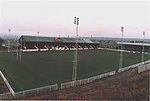
Fartown Ground
Fartown Ground

The Fartown Ground or just simply Fartown is a sports ground located in the Huddersfield suburb of Fartown in West Yorkshire, England and is predominantly famous for being the home ground of Huddersfield Rugby League Club from 1878 to 1992. The grounds consisted of a rugby ground, a cricket ground used by Yorkshire County Cricket Club, Bowling greens and a running track as well as a pavilion. It was the scene of many great games, including the Challenge Cup finals of 1908 and 1910, several Challenge Cup semi finals, John Player Cup finals and international matches. Although the stands were all demolished, the pitch, floodlights and bankings where the terraces once stood are still there, Huddersfield RLFC played their last game there on 23 August 1992, up until the mid 2000s the club's junior and reserves sides still played on the pitch at Fartown but the stands were already demolished by then. The ground had fallen into serious decline in the 1980s, The Main stand was closed in 1986 due to safety issues after the Bradford City stadium fire in 1985 and partly reopened in 1989, a large chunk of the terrace side was condemned and never reopened, the supporters club building was demolished in 2009 after a fire.It also hosted an FA Cup semi final game between Blackburn Rovers and Sheffield Wednesday in 1882.Huddersfield are still known as "Fartown" or "the Fartowners" by many of their older supporters. The highest attendance at the stadium to watch a Huddersfield game was 32,912 against Wigan on 4 March 1950, although a Challenge Cup semi-final played 19 April 1947 attracted a crowd of 35,136.