Cerro del Topo Chico
Landforms of Nuevo LeónLandmarks in MonterreyMountains of Mexico

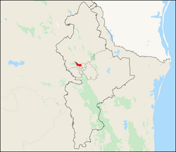
The Cerro del Topo Chico (Spanish, 'Small Mole Hill', from the Latin talpa 'mole') is a mountain and a protected area in the Escobedo, San Nicolás and Monterrey municipalities; state of Nuevo León, Mexico. The summit reaches 1,178 meters above sea level, and it has 618 meters of prominence (Parent: Cerro de las Mitras). The mountain is about 7.5 km long, is a symbol of Escobedo and San Nicolás, and is completely surrounded by Monterrey metropolitan area. It is known for being the source of the Topo Chico mineral water.
Excerpt from the Wikipedia article Cerro del Topo Chico (License: CC BY-SA 3.0, Authors, Images).Cerro del Topo Chico
Calle Hacienda Santa Julia, General Escobedo
Geographical coordinates (GPS) Address Nearby Places Show on map
 Continue reading on Wikipedia
 Geographical coordinates (GPS)
| Latitude | Longitude |
|---|---|
| N 25.773333333333 ° | E -100.34972222222 ° |
Address
Reserva Natural Estatal Cerro del Topo
Calle Hacienda Santa Julia
66073 General Escobedo
Nuevo León, Mexico
Open on Google Maps