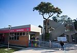
Barueri
BarueriPages with Portuguese IPAPopulated places established in 1560

Barueri (Portuguese pronunciation: [bɐˌɾu.eˈɾi] or [baɾweˈɾi]) is a Brazilian municipality in the State of São Paulo located in the northwestern part of the Metropolitan Region of São Paulo. The population is 276,982 (2020 est.) in an area of 65.70 km2 (25.37 sq mi).Its boundaries are Santana de Parnaíba to the north, Osasco in the east, Carapicuíba in the Southeast, Jandira to the south and southwest, and Itapevi the west. The city is served by the trains of line 8 of the Companhia Paulista de Trens Metropolitanos (literally São Paulo Metropolitan Railway Company), (CPTM).
Excerpt from the Wikipedia article Barueri (License: CC BY-SA 3.0, Authors, Images).Barueri
Avenida Henriqueta Mendes Guerra, Barueri Centro (Barueri)
Geographical coordinates (GPS) Address Phone number Website Nearby Places Show on map
Geographical coordinates (GPS)
| Latitude | Longitude |
|---|---|
| N -23.511111111111 ° | E -46.876388888889 ° |
Address
Paróquia São João Batista
Avenida Henriqueta Mendes Guerra 212
06401-160 Barueri, Centro (Barueri)
São Paulo, Brazil
Open on Google Maps


