place

Port Kent station

Amtrak stations in New York (state)Former Delaware and Hudson Railway stationsNew York (state) railway station stubsTransportation buildings and structures in Essex County, New York
Port Kent, NY, train station

Port Kent station is a temporarily closed Amtrak intercity train station in Port Kent, New York, normally served by the Adirondack. It is only served when the Lake Champlain Transportation Company Port Kent–Burlington Ferry is in operation – typically from May to October (typically Columbus Day). The station has one low-level side platform on the west side of the single track. The Delaware and Hudson Railroad built a freight station on the shores of Port Kent sometime between 1875 and 1876, and an open shelter in 1911, similar to the existing one. Amtrak has stopped at Port Kent since April 24, 1977, with a wood shelter added in 1989. In March 2020, the Adirondack was cancelled north of Albany–Rensselaer after all non-essential travel across the Canada–United States border was banned in response to the COVID-19 pandemic. Service resumed on April 3, 2023; however, the stop at Port Kent remained closed because ferry service remained suspended.

Excerpt from the Wikipedia article Port Kent station (License: CC BY-SA 3.0, Authors, Images).

Port Kent station
State Highway 373, Town of Chesterfield

Geographical coordinates (GPS) Address External links Nearby Places
placeShow on map

Wikipedia: Port Kent stationContinue reading on Wikipedia

Geographical coordinates (GPS)

Latitude Longitude
N 44.524 ° E -73.4035 °
placeShow on map

Address

Port Kent

State Highway 373 41
12944 Town of Chesterfield
New York, United States
mapOpen on Google Maps

linkWikiData (Q3097331)
linkOpenStreetMap (319976634)

Port Kent, NY, train station
Share experience

Nearby Places

Champlain Valley
Champlain Valley

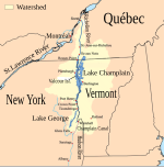
The Champlain Valley is a region of the United States around Lake Champlain in Vermont and New York extending north slightly into Quebec, Canada. It is part of the St. Lawrence River drainage basin, drained northward by the Richelieu River into the St. Lawrence at Sorel-Tracy, Quebec (northeast of Montreal). The Richelieu valley is not generally referred to as part of the Champlain Valley. The Champlain Lake Valley is the most heavily populated region in Vermont, broadly stretching eastward from the lake's shore to the base of the Green Mountains. The state's largest city, Burlington, is located on the lake, and the city's associated suburban communities encompass part of the central section of the valley. Beyond urbanized Chittenden County, however, the valley's landscape is primarily open pasture and row crops, making the Champlain Valley the most productive agricultural region of Vermont. The New York portion of the Champlain Valley includes the eastern portions of Clinton County and Essex County. Most of this area is part of the Adirondack Park, offering tremendous views of the Adirondack High Peaks region and many recreational opportunities in the park and along the relatively undeveloped coast line of Lake Champlain. The city of Plattsburgh is to the north, and the historic town of Ticonderoga is in the southern part of the region. The northern part of Lake George is located at, and near Ticonderoga, and therefore is a part of the Champlain Valley.