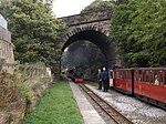
Upper Denby
AC with 0 elementsDenby DaleUse British English from July 2019Villages in West YorkshireWest Yorkshire geography stubs

Upper Denby is a small village within the civil parish of Denby Dale, and the borough of Kirklees in West Yorkshire, England. Lying 11 miles (17 km) to the south-east of Huddersfield and 2 miles (3 km) south of Denby Dale, on an east facing slope of the Pennines, it occupies a position 820 feet (250 m) above sea level. The southern edge of the village is bordered by the Metropolitan borough of Barnsley within the county of South Yorkshire.
Excerpt from the Wikipedia article Upper Denby (License: CC BY-SA 3.0, Authors, Images).Upper Denby
Gunthwaite Lane,
Geographical coordinates (GPS) Address Nearby Places Show on map
Geographical coordinates (GPS)
| Latitude | Longitude |
|---|---|
| N 53.56 ° | E -1.655 ° |
Address
Gunthwaite Lane
Gunthwaite Lane
S36 7GE , Gunthwaite and Ingbirchworth
England, United Kingdom
Open on Google Maps


