Rosario Strait

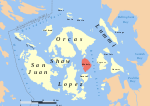
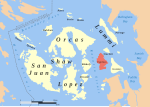
Rosario Strait is a strait in northern Washington state, separating San Juan County and Skagit and Whatcom Counties. It extends from the Strait of Juan de Fuca about 23 kilometres (14 mi) north to the Strait of Georgia. The USGS defines its southern boundary as a line extending from Point Colville on Lopez Island to Rosario Head on Fidalgo Island, and its northern boundary as a line from Point Migley on Lummi Island to the east tip of Puffin Island (just east of Matia Island) and then to Point Thompson on Orcas Island. Rosario Strait runs north-south between Lopez, Decatur, Blakely, and Orcas Islands on the west, and Fidalgo, Cypress, Sinclair, and Lummi Islands on the east.Rosario Strait is a major shipping channel. More than 500 oil tankers pass through the strait each year, to and from the Cherry Point Refinery and refineries near Anacortes. The strait is in constant use by vessels bound for Cherry Point, Bellingham, Anacortes, and the San Juan Islands. Vessels bound for British Columbia or Alaska also frequently use it in preference to the passages farther west, when greater advantage can be taken of the tidal currents.
Excerpt from the Wikipedia article Rosario Strait (License: CC BY-SA 3.0, Authors, Images).Rosario Strait
Geographical coordinates (GPS) Address Nearby Places Show on map
Geographical coordinates (GPS)
| Latitude | Longitude |
|---|---|
| N 48.5 ° | E -122.75 ° |
Address
San Juan County
Washington, United States
Open on Google Maps


