St Giles, London
Areas of LondonBills of mortality parishesDistricts of the London Borough of CamdenFormer civil parishes in LondonFormer slums of London ... and 2 more
St Giles, LondonUse British English from August 2013

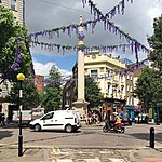
St Giles is an area in the West End of London in the London Borough of Camden. It gets its name from the parish church of St Giles in the Fields. The combined parishes of St Giles in the Fields and St George Bloomsbury (which was carved out of the former) were administered jointly for many centuries; leading to the conflation of the two, with much or all of St Giles usually taken to be a part of Bloomsbury. Points of interest include the church of St Giles in the Fields, Seven Dials, the Phoenix Garden and St Giles Circus.
Excerpt from the Wikipedia article St Giles, London (License: CC BY-SA 3.0, Authors, Images).St Giles, London
Mercer Street, London Bloomsbury (London Borough of Camden)
Geographical coordinates (GPS) Address Nearby Places Show on map
Geographical coordinates (GPS)
| Latitude | Longitude |
|---|---|
| N 51.5143 ° | E -0.127 ° |
Address
Mercer Street Hotel
Mercer Street
WC2H 9QS London, Bloomsbury (London Borough of Camden)
England, United Kingdom
Open on Google Maps


