Karmei Tzur
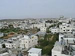
Karmei Tzur, or Carmei Tzur (Hebrew: כַּרְמֵי צוּר) is an Israeli settlement organized as a community settlement in the West Bank located north of Hebron in the Judean hills between the Palestinian towns of Beit Ummar and Halhul. The National Religious community falls under the jurisdiction of Gush Etzion Regional Council. Under the terms of the Oslo Accords of 1993 between Israel and the Palestine Liberation Organization, Karmei Tzur was designated Area "C" under full Israeli civil and security control. In 2021 it had a population of 965. The international community considers Israeli settlements in the West Bank illegal under international law, but the Israeli government disputes this.According to a Peace Now-report of 2006, 27% of the land on which Karmei Tzur is built is privately owned, all or most of it, by Palestinians. According to Israeli law, settlements on privately owned Palestinian land are illegal.
Excerpt from the Wikipedia article Karmei Tzur (License: CC BY-SA 3.0, Authors).Karmei Tzur
Geographical coordinates (GPS) Address Nearby Places Show on map
Geographical coordinates (GPS)
| Latitude | Longitude |
|---|---|
| N 31.609166666667 ° | E 35.101388888889 ° |
Address
Judea and Samaria, Palestinian Territories
Open on Google Maps


