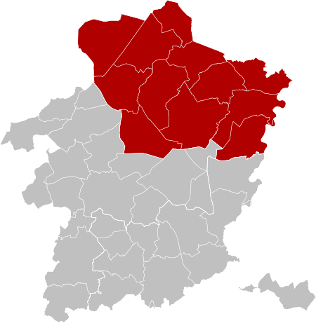
Arrondissement of Maaseik
Arrondissements of Limburg (Belgium)Belgian Limburg geography stubs

The Arrondissement of Maaseik (Dutch: Arrondissement Maaseik; French: Arrondissement de Maaseik) is one of the three administrative arrondissements in the Province of Limburg, Belgium. It is not a judicial arrondissement. The municipalities of Bocholt, Bree, Kinrooi, Meeuwen-Gruitrode, Dilsen-Stokkem and Maaseik, are part of the Judicial Arrondissement of Tongeren, while the rest of its municipalities are part of the Judicial Arrondissement of Hasselt.
Excerpt from the Wikipedia article Arrondissement of Maaseik (License: CC BY-SA 3.0, Authors, Images).Arrondissement of Maaseik
Vlasrootweg,
Geographical coordinates (GPS) Address Nearby Places Show on map
Geographical coordinates (GPS)
| Latitude | Longitude |
|---|---|
| N 51.15 ° | E 5.5 ° |
Address
Vlasrootweg 33
3990
Limburg, Belgium
Open on Google Maps


