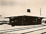
Alewife station

Alewife station is a Massachusetts Bay Transportation Authority (MBTA) intermodal transit station in the North Cambridge neighborhood of Cambridge, Massachusetts. It is the northwest terminal of the rapid transit Red Line (part of the MBTA subway system) and a hub for several MBTA bus routes. The station is at the confluence of the Minuteman Bikeway, Alewife Linear Park, Fitchburg Cutoff Path, and Alewife Greenway off Alewife Brook Parkway adjacent to Massachusetts Route 2, with a five-story parking garage for park and ride use. The station has three bike cages. Alewife station is named after nearby Alewife Brook Parkway and Alewife Brook, themselves named after the alewife fish. The Fitchburg Railroad (now the MBTA Commuter Rail Fitchburg Line) opened through North Cambridge in 1842, followed by the now-closed Lexington Branch and Fitchburg Cutoff branch lines. An extension of the 1912-opened Cambridge–Dorchester line to North Cambridge was first proposed in the 1930s, though planning for the project did not begin until the 1960s. The Red Line Northwest Extension project included a station at Alewife Brook Parkway to capture traffic from Route 2, as a planned extension of the highway was cancelled in 1970. Construction began in 1979; with the planned route to Arlington Heights rejected by Arlington, Alewife became the terminus of the extension. Alewife station opened on March 30, 1985, though some peak-hour service did not run to the station until that December. The station has a single underground island platform, with a busway and glass-roofed fare lobby inside the parking garage. Ramps connecting the garage to Route 2 opened in 1986. The station spurred transit-oriented development on formerly industrial land in the surrounding area. Although designed for two additional levels, the garage has not been expanded; repairs and elevator replacements began in 2018. The station features six works of public art built under the Arts on the Line program.
Excerpt from the Wikipedia article Alewife station (License: CC BY-SA 3.0, Authors, Images).Alewife station
Cambridgepark Drive, Cambridge
Geographical coordinates (GPS) Address Nearby Places Show on map
Geographical coordinates (GPS)
| Latitude | Longitude |
|---|---|
| N 42.3964 ° | E -71.142 ° |
Address
Alewife Station Parking Garage
Cambridgepark Drive 5;7
02475 Cambridge
Massachusetts, United States
Open on Google Maps


