place

Island Beach, New Jersey

1933 establishments in New Jersey1965 disestablishments in New JerseyBerkeley Township, New JerseyFormer boroughs in New JerseyFormer municipalities in Ocean County, New Jersey
Geography of Ocean County, New JerseyGhost towns in New JerseyPages with non-numeric formatnum argumentsPopulated places established in 1933Use mdy dates from July 2023

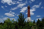
Island Beach was a borough that existed in Ocean County, New Jersey, United States, from 1933 to 1965. Island Beach was incorporated as a borough by an Act of the New Jersey Legislature on June 23, 1933, from portions of Berkeley Township, Lacey Township and Ocean Township. The referendum that approved the borough's formation was passed on August 18, 1933. Most of the land that made up the new borough — 2,694 acres (10.90 km2) worth — had been purchased by Henry Phipps, a partner of Andrew Carnegie, in 1926. Phipps had hired Francis Parkman Freeman to act as foreman of the Island Beach estate, and Freeman and his wife Augusta Huiell Seaman shared the various local government positions between them. The population reached a peak of 31 in the 1940 Census, and following a government-ordered evacuation during World War II for work on Operation Bumblebee, the population had dropped off to 13 by 1950 and was down to 11 in the 1960 tally, the last before the borough was disincorporated.The borough lasted until July 6, 1965, when it was absorbed into Berkeley Township. The territory now comprises Island Beach State Park.

Excerpt from the Wikipedia article Island Beach, New Jersey (License: CC BY-SA 3.0, Authors).

Island Beach, New Jersey
Central Avenue,

Geographical coordinates (GPS) Address Nearby Places
placeShow on map

Wikipedia: Island Beach, New JerseyContinue reading on Wikipedia

Geographical coordinates (GPS)

Latitude Longitude
N 39.8434 ° E -74.0887 °
placeShow on map

Address

Central Avenue

Central Avenue

New Jersey, United States
mapOpen on Google Maps

Share experience

Nearby Places

Barnegat Bay
Barnegat Bay

Barnegat Bay is a small brackish arm of the Atlantic Ocean, approximately 42 miles (68 km) long, along the coast of Ocean County, New Jersey in the United States. It is separated from the Atlantic by the long Island Beach State Park (colloquially called a "barrier island"), as well as by the north end of Long Beach Island, popular segments of the Jersey Shore. The bay is fed by several small rivers, including the Toms River, the Forked River, the Metedeconk River, Cedar Creek, Oyster Creek, Mill Creek, Westecunk Creek, and Tuckerton Creek, all of which empty into the bay through small estuaries along its inner shore. The communities of Toms River, Silverton, and Forked River sit along the river estuaries on the bay. The bay connects with the ocean through the Barnegat Inlet, along which sits the Barnegat Lighthouse. The bay is part of the Atlantic Intracoastal Waterway, entered on its north end by the Point Pleasant Canal and connecting on the south end with Little Egg Harbor via the small Manahawkin Bay. In a broader sense, Barnegat Bay is sometimes considered to stretch to the south end of Long Beach Island and to include Little Egg Harbor. Three bridges span the bay from the mainland to the peninsula: the Mantoloking Bridge from Brick Township to Mantoloking, and the Thomas A. Mathis and J. Stanley Tunney Bridges from Toms River to Ortley Beach. The Barnegat Division of Edwin B. Forsythe National Wildlife Refuge comprises wetlands along the inner southern part of the bay. Along the outside of the bay, on the peninsula, is the Island Beach State Park. Various islands within the bay are a part of the National Wildlife Refuge or the Sedge Islands State Wildlife Management Area. The northern tip of Long Beach Island includes the Barnegat Lighthouse State Park.

Island Beach State Park, New Jersey

Island Beach State Park is a New Jersey state park located just south of Seaside Park on the Barnegat Peninsula in Berkeley Township, Ocean County, New Jersey, United States. The park is operated and maintained by the New Jersey Division of Parks and Forestry. Most of the park encompasses the former borough of Island Beach. The park is the largest reserve of undeveloped barrier island in New Jersey and one of the largest in the United States. The park is divided into two areas. The Island Beach Northern Natural Area covers 659 acres (2.7 km2), some of which is restricted to the public. The Southern Natural Area is much larger at 1,237 acres (5 km2). The park includes the Sedge Island Marine Conservation Zone, which includes about 1,600 acres (6 km2) of tidal marshes, creeks, ponds, and open water. Coming in from the sea-front, a visitor ascends over a large primary dune covered in tall grasses and down into a narrow maritime forest, consisting of many tall bushes and short trees including holly, goldenrod and black cherry. Approaching the bay side, one finds reeds and a muddy estuary that is home to blue crabs and herons and other marine birds. The park is an excellent site for bird watching with osprey nests and bird blinds set up. The Barnegat Inlet is located at the southern tip of the park, separating the Barnegat Peninsula from Long Beach Island. Swimming, kayaking, and fishing are permitted in some areas of the park. Four wheel drive vehicles are permitted onto the beach with a permit.

Seaside Park School District

The Seaside Park School District is a non-operating community public school district that operated one school serving students in Kindergarten through sixth grade from Seaside Park, New Jersey, United States, until it closed at the end of the 2009-10 school year. District officials announced in May 2010 that the school would be closing and that students would attend elementary schools in the nearby Toms River Regional Schools for grades K-6. Officials cited costs of $37,000 per student if the school remained open, versus $10,500 per student if attending the Toms River district. The shared services agreement was renewed for the 2013-2014 school year.As of the 2008-09 school year, the district's one school had an enrollment of 71 students and 11.6 classroom teachers (on an FTE basis), for a student–teacher ratio of 6.1.The district was classified by the New Jersey Department of Education as being in District Factor Group "DE", the fifth-highest of eight groupings. District Factor Groups organize districts statewide to allow comparison by common socioeconomic characteristics of the local districts. From lowest socioeconomic status to highest, the categories are A, B, CD, DE, FG, GH, I and J.Public school students in seventh through twelfth grades attend the schools of the Central Regional School District, which serves students from Island Heights and from the municipalities of Berkeley Township, Ocean Gate, Seaside Heights and Seaside Park.. Schools in the district (with 2017-18 enrollment data from the National Center for Education Statistics) are Central Regional Middle School for grades 7 and 8 (761 students) and Central Regional High School for grades 9 - 12 (1,401 students). The district's Board of Education consists of nine members, who are directly elected by the residents of the constituent municipalities to three-year terms of office on a staggered basis, with three seats up for election each year. Seaside Park is allocated one of the board's nine seats.

Lanoka Harbor, New Jersey

Lanoka Harbor is an unincorporated community located within Lacey Township, in Ocean County, in the U.S. state of New Jersey.Lanoka Harbor and Murray Grove were established in the mid-18th century and are representative of the typical bay town, often referred to as the "Barnegat Bay resorts." The communities fronting the bay relied on the products of forest trade and sea, including a substantial oyster industry, long before the railroad brought resort trade. Murray Grove is further renowned as the "birthplace of Universalism in America," where the first Universalist sermon in the United States was preached. The Unitarian influence remained in the community, with the establishment of the Murray Grove Universalist and Unitarian Retreat and Conference Center in the early 1800s. The community of Lanoka Harbor was named after the abundance of oak trees located along George Lane; with the original name being "Lanes Oaks", which was eventually shortened to "Lanoka". In 1924, Samuel Rogers added "Harbor" in an attempt to attract tourism to the shore community. Located within Lanoka Harbor is the Lacey Township School District; which includes Lacey Township High School, Lanoka Harbor Elementary School, Mill Pond Elementary School, and Cedar Creek Elementary School. Lanoka Harbor receives emergency services from Lanoka Harbor EMS (Squad 26), Lanoka Harbor Fire Company (Station 61), Lacey Township Underwater Rescue and Recovery (Squad 47) and the Lacey Township Police Department.