Muncy Creek

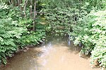
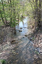
Muncy Creek (also known as Big Muncy Creek) is a tributary of the West Branch Susquehanna River in Sullivan County and Lycoming County, at Pennsylvania, in the United States. It is approximately 34.5 miles (55.5 km) long. The watershed of the creek has an area of 216 square miles (560 km2). The creek's discharge averages 49 cubic feet per second (1.4 m3/s) at Sonestown, but can be up to a thousand times higher at Muncy. The headwaters of the creek are on the Allegheny Plateau. Rock formations in the watershed include the Chemung Formation and the Catskill Formation. There are a number of lakes in the watershed of Muncy Creek, including Eagles Mere Lake, Highland Lake, and Beaver Lake. The creek was known as Occohpocheny to Native Americans. The area in its vicinity was settled in 1783. Various other industries and mills were constructed in the creek's vicinity from the late 18th century to the early 20th century. Wild trout naturally reproduce in part of Muncy Creek. Part of the creek is navigable by canoe.
Excerpt from the Wikipedia article Muncy Creek (License: CC BY-SA 3.0, Authors, Images).Muncy Creek
Aquatic Road, Muncy Creek Township
Geographical coordinates (GPS) Address Nearby Places Show on map
Geographical coordinates (GPS)
| Latitude | Longitude |
|---|---|
| N 41.2098 ° | E -76.8033 ° |
Address
Aquatic Road
Aquatic Road
17756 Muncy Creek Township
Pennsylvania, United States
Open on Google Maps


