place

Edmonton

1892 establishments in AlbertaCities in AlbertaEdmontonEdmonton Metropolitan RegionHudson's Bay Company trading posts
Pages including recorded pronunciationsPages with non-numeric formatnum argumentsPopulated places established in 1795Populated places established in 1904Use Canadian English from March 2015Use mdy dates from April 2022
Edmonton Montage 2020

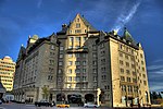
Edmonton ( (listen) ED-mən-tən) is the capital city of the Canadian province of Alberta. Edmonton is situated on the North Saskatchewan River and is the centre of the Edmonton Metropolitan Region, which is surrounded by Alberta's central region. The city anchors the north end of what Statistics Canada defines as the "Calgary–Edmonton Corridor".As of 2021, Edmonton had a city population of 1,010,899 and a metropolitan population of 1,418,118, making it the fifth-largest city and sixth-largest metropolitan area (CMA) in Canada. Edmonton is North America's northernmost large city and metropolitan area comprising over one million people each. A resident of Edmonton is known as an Edmontonian.Edmonton's historic growth has been facilitated through the absorption of five adjacent urban municipalities (Strathcona, North Edmonton, West Edmonton, Beverly and Jasper Place) in addition to a series of annexations through 1982, and the annexation of 8,260 ha (82.6 km2; 31.9 sq mi) of land from Leduc County and the City of Beaumont on January 1, 2019. Known as the "Gateway to the North", the city is a staging point for large-scale oil sands projects occurring in northern Alberta and large-scale diamond mining operations in the Northwest Territories.Edmonton is a cultural, governmental and educational centre. It hosts a year-round slate of festivals, reflected in the nickname "Canada's Festival City". It is home to North America's second largest mall, West Edmonton Mall (the world's largest mall from 1981 until 2004), and Fort Edmonton Park, Canada's largest living history museum.

Excerpt from the Wikipedia article Edmonton (License: CC BY-SA 3.0, Authors, Images).

Edmonton
James MacDonald Bridge, Edmonton Central Core

Geographical coordinates (GPS) Address Nearby Places
placeShow on map

Wikipedia: EdmontonContinue reading on Wikipedia

Geographical coordinates (GPS)

Latitude Longitude
N 53.534444444444 ° E -113.49027777778 °
placeShow on map

Address

James MacDonald Bridge 9720
T5K 2L1 Edmonton, Central Core
Alberta, Canada
mapOpen on Google Maps

Edmonton Montage 2020
Share experience

Nearby Places

James MacDonald Bridge

The James MacDonald Bridge is a bridge that spans the North Saskatchewan River in Edmonton, Alberta, Canada. Construction of the bridge began in the early 1960s and was completed in October 1971. The bridge was named after city engineer James MacDonald.This span was designed to carry the 5 westbound collector lanes of the south leg of the "downtown freeway loop", as conceived under the "METS" design study. This explains the "overbuilt" appearance of the still existing interchange system on the east side of the North Saskatchewan River and the truncated appearance of the ramps at the east end of the bridge. Most of these ramp alignments were sited as temporary connectors under the phased construction planning, yet continue to serve in their original state. If this project had proceeded through to its ultimate stage, three additional spans would have been erected at this location, all south of the existing one. Upon completion, the entire area at the east end of this bridge would have been occupied by a massive three level cloverstack interchange serving the south and east legs of the downtown loop, the planned 98 ave 6 lane arterial (indicated as "future freeway" on the ultimate stage drawing), and the southeast (Mill Creek) freeway. The Mill Creek Freeway was to run south following the current 91 Street alignment, ultimately joining Highway 2 in the vicinity of Nisku. The reference provided shows the entire conceptual design for this project. The current tunnel carrying 97 Avenue underground to 109 St. is another part of this large project. The bridge connects the communities of Cloverdale on the east end to Rossdale on the west end.

ATB Place
ATB Place

ATB Place, formerly Telus Plaza, is an office complex in Edmonton, Alberta, Canada. Originally built as the headquarters of Alberta Government Telephones (AGT), the two office towers in the complex–ATB Place Tower and TELUS house–are now separately owned and serve as the headquarters of ATB Financial and the Alberta provincial headquarters for Telus, respectively. The south tower, TELUS House (formerly TELUS Plaza South, and originally the AGT Tower (Alberta Government Telephones Tower)), was completed in 1971, at a cost of Can$22 million. It was Edmonton's tallest building until Manulife Place was completed in 1981. It is 134.4 metres (34 storeys) tall. For many years the 33rd floor was home to Vista 33, a telephone and telecommunications museum. There was also an observation deck which afforded panoramic views of Edmonton from what was then the city's tallest building. Vista 33 was closed in 1993.ATB Tower is 90 metres tall (26 storeys, 296 feet) and was completed in 1969. It contains retail space at the ground level and via Edmonton Pedway system to the Edmonton LRT in the concourse of ATB Place. The concourse courtyard was added after TELUS moved in and renovated it. It opened as McCauley Plaza, named after the first mayor of Edmonton, in which a bronze bust was displayed. The location was later renamed TELUS Plaza. After the name change to ATB Place, the bust was removed from public viewing. A third building, the two storey ATB Place annex, is located at the southeast corner of the complex. Originally the home of the (now defunct) Edmonton Club, later the main office of an engineering firm, it is currently occupied by a career college. Prior to the construction of the AGT buildings, this site was the home of the main branch of the Edmonton Public Library, which stood there from 1923 to 1969.