place

Caesarscreek Township, Ohio

1803 establishments in OhioTownships in Greene County, OhioTownships in OhioUse mdy dates from July 2023
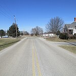
Northern Caesarscreek Township by air

Caesarscreek Township is one of the twelve townships of Greene County, Ohio, United States. As of the 2020 census the township population was 1,185.

Excerpt from the Wikipedia article Caesarscreek Township, Ohio (License: CC BY-SA 3.0, Authors, Images).

Caesarscreek Township, Ohio
Caesarscreek Township

Geographical coordinates (GPS) Address Nearby Places
placeShow on map

Wikipedia: Caesarscreek Township, OhioContinue reading on Wikipedia

Geographical coordinates (GPS)

Latitude Longitude
N 39.586388888889 ° E -83.851666666667 °
placeShow on map

Address

Middleton Corner


Caesarscreek Township
Ohio, United States
mapOpen on Google Maps

Northern Caesarscreek Township by air
Share experience

Nearby Places

Keiter Mound
Keiter Mound

The Keiter Mound (designated 33-Cn-15) is a Native American mound in the southwestern part of the U.S. state of Ohio. Located north of the city of Wilmington, it sits on a wooded hill above the stream bottom of a small secondary creek, the Anderson Fork. About 5.5 feet (1.7 m) tall at its highest point, the mound measures 58 feet (18 m) from north to south and 65 feet (20 m) from east to west. Due to its location, the Keiter Mound is believed to be a work of Hopewellian peoples. Unlike many Hopewell sites, such as the Newark Earthworks or Mound City, the Keiter Mound is isolated: no other mounds and no large geometric earthworks are located nearby. As such, it is likely to have been created by small groups of transient hunters who camped in the valley below. This identification is based on the mound's location and comparison with similar mounds: as the mound has never been substantially excavated, it likely holds the same grave goods as it did when it was constructed thousands of years ago. The top is flat and slightly scarred, possibly from an early excavation, but for all practical purposes the mound is in pristine condition. For this reason, it is a significant archaeological site: it is an unusually well preserved example of isolate Hopewell construction and might be able to yield important information about the Hopewell way of life. In recognition of its archaeological significance, the Keiter Mound was listed on the National Register of Historic Places in 1975.

Dean Family Farm

The Dean Family Farm, listed since 1975 as a historic site on the National Register of Historic Places, has its origins with the immigration of Daniel Dean, a native of Tobermore, County Londonderry, Ireland, to Philadelphia, Pennsylvania, in 1784 when he was aged 18, according to Dean family histories. Daniel was a son of George Roger Dean, who fought in the Colonial line, and Mary Campbell who was reared with her sister by the Duke of Argyl at Inveraray Scotland, the clan Campbells' ancestral home.The National Register and an Ohio Historic Inventory, dated 11 October 1974, list the historic site at 199 N. Ballard Road, Xenia, as having five buildings dating from the 1820s on 157 acres (0.6 km2) along Caesar's Creek in Greene County, Ohio. The National Register listing was expanded by a boundary increase adding 199 Ballard in 1994, and renaming as the Dean Family Farm Historic District.Daniel Dean, born October 20, 1766, in Ireland was a son of George Roger Dean, whom DAR archival records list as a Pennsylvania sergeant and militiaman in the 1770s, along with his elder brothers James and David Dean. A weaver by trade, Daniel Dean lived briefly in Pennsylvania, Maryland and Virginia before meeting and marrying Jannet "Jenny" Steele (1768-November 18, 1841), a Scots-Irish girl of Steele's Tavern in Augusta County, Virginia. The couple relocated near Mount Sterling, Kentucky, where Dean built a mill, a house for the couple and another for his sister and mother, both named Mary, whom he brought from Ireland to Kentucky via Wilmington, North Carolina, in 1790. Daniel and Jannet had the first of their 11 children while in Kentucky. But when Ohio became a free state in 1803, Dean, an ardent abolitionist, scouted out the new lands north of the Ohio River with his brother-in-law, Henry Barnes, a skilled builder whose son later would become Greene County's wartime sheriff and treasurer. Dean, shortly thereafter, bought 2,000 acres (8.1 km2) on Caesar's Creek near the settlement of Xenia, but he spent several years litigating to perfect his title. Once his title was secure, Dean joined Barnes and their families in relocating via Fort Washington (later Cincinnati) to Greene County in September 1812. They first dined using as a table a huge, flat rock—then began a lucrative business in which Dean harvested and milled timber for lumber used by Barnes to build homes in and near Xenia, Ohio. Dean's son, Joseph (1804–83), wed Hannah Boggs (1809–88)and, according to Dean Family records, Joseph built the first substantial two-story home on the family farm in 1823, a house that still stands. Daniel Dean, descended from Covenanter Presbyterians, was a church stalwart. At least 36 of his 111 progeny enlisted and served honorably in the Union Army during the Civil War, according to records read at an 1880 Dean family picnic. The elder Dean, who died January 24, 1843, at age 77, is buried alongside his wife, Jannet, in the Dean Family Cemetery in New Jasper Township. The cemetery and farm, privately owned, were added to the National Register of Historic Places in 1994. The historic Ballard Road Covered Bridge stands just off Route 35 nearby and spans a fork of Caesar's Creek. Greene County (Ohio) Public Library archives feature maps, from 1855, 1874 and 1896, depicting the original Dean Family Farm acreage divided among Daniel's heirs — Joseph, William, John, Levi, D. S. Dean and others. Lands lie along the Jamestown Turnpike, now U.S. Route 35.

Ballard Road Covered Bridge

The Ballard Road Covered Bridge is a historic wooden covered bridge in the southwestern part of the U.S. state of Ohio. Built in the late nineteenth century and since bypassed, the bridge has been named a historic site. Following a design by H.E. Hebble, James E. Brown built the bridge across Caesar's Creek in 1883. He chose to name it for a nearby industrialist, Lyman Ballard, who had constructed a water-powered mill on the creek to grind grain approximately thirty years before. Brown chose a seven-panel Howe truss design for the bridge, which measures 80 feet (24 m) in length. Built of wood with iron elements on abutments of limestone and covered with a metal roof, the single-span bridge is covered with vertical siding and retains the original square shape of its portals. Much of Greene County is underlain by high-quality limestone (the McDonald Farm near Xenia supplied limestone for the Washington Monument) and from this limestone the bridge's abutments were taken; it appears that the quarries for the abutments were located elsewhere in the surrounding New Jasper Township.Although the Ballard Road Bridge remains in its original rural setting, its surroundings are no longer as quiet as originally; U.S. Route 35 has been constructed as a controlled-access highway immediately to the south, and Ballard Road now dead-ends at the bridge. By the 1970s, it was one of just eighteen Howe truss covered bridges remaining in Ohio, although thousands of bridges were built to this design in the 19th century throughout the United States. As such, it was deemed historically significant enough to qualify to be added to the National Register of Historic Places in 1975. The Ballard Road Bridge is one of five covered bridges in Greene County, and the only one open to road traffic.