place

Thames, New Zealand

Pages including recorded pronunciationsPopulated places around the Firth of ThamesPopulated places in WaikatoThames-Coromandel DistrictUse New Zealand English from March 2024

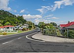
Thames ( ) (Māori: Pārāwai) is a town at the southwestern end of the Coromandel Peninsula in New Zealand's North Island. It is located on the Firth of Thames close to the mouth of the Waihou River. The town is the seat of the Thames-Coromandel District Council. The Māori iwi are Ngāti Maru, who are descendants of Marutuahu's son Te Ngako. Ngāti Maru is part of the Ngati Marutuahu confederation of tribes or better known as Hauraki Iwi. Thames had an estimated population of 15,000 in 1870, but this declined to 4,500 in 1881, and it has increased modestly since. It is still the biggest town on the Coromandel Peninsula. Until 2016, a historical oak tree that was planted by Governor George Grey stood on the corner of Grey and Rolleston streets.

Excerpt from the Wikipedia article Thames, New Zealand (License: CC BY-SA 3.0, Authors).

Thames, New Zealand
SH 25,

Geographical coordinates (GPS) Address Nearby Places
placeShow on map

Wikipedia: Thames, New ZealandContinue reading on Wikipedia

Geographical coordinates (GPS)

Latitude Longitude
N -37.138388888889 ° E 175.5405 °
placeShow on map

Address

SH 25
, Moanataiari
Waikato, New Zealand
mapOpen on Google Maps

Share experience

Nearby Places

Kopu Bridge
Kopu Bridge

The Historic Kopu Bridge (originally Hauraki Bridge and sometimes Waihou River Bridge) is a single-lane swing bridge that spans the Waihou River, near its emergence into the Firth of Thames in the Thames-Coromandel District of New Zealand's North Island. The bridge was completed in 1928 and was part of State Highway 25. The swinging span in the middle of the bridge is 43 metres long and with an overall length of 463 metres, the bridge was the longest and oldest single lane bridge within the state highway network. It is also New Zealand's only remaining operational swing bridge. As the first available crossing of the Waihou River and the main link between the Hauraki Plains and Coromandel Peninsula, it sees a lot of traffic, especially during holidays. Due to a gradual increase in the traffic between Auckland and the Coromandel Peninsula, by the early 1990s the bridge became the most heavily used single lane bridge in the country, with traffic volumes of an average of 9,000 vehicles per day. Traffic flow over the bridge was controlled by traffic lights and the bridge was notorious for queues which formed during peak times such as holiday weekends, when three hours delay were common. Rarely used as boat traffic declined (especially for shipping use, with the river once navigable all the way up to the town of Paeroa) in the latter years before it was closed to traffic, the swing span could still be opened to provide a 15.3 m wide channel to passing vessels. The bridge is the only surviving road bridge of the swing span type in the country and Heritage New Zealand lists the bridge as a Category 1 historic place, while it is also on the IPENZ Engineering Heritage Register. In December 2011 a new two-lane bridge opened directly to the south of the old bridge. The old bridge remains under active threat of demolition. However a local group, the Historic Kopu Bridge Society has been working since 2011 to retain the bridge into community ownership, so that it may remain as a pedestrian and cycleway and NZ's last remaining operational swingbridge.