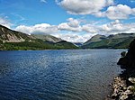
Crag Fell
Borough of CopelandFells of the Lake District

Crag Fell is a hill in the English Lake District. It is part of the Lank Rigg group, standing above Ennerdale Water in the Western Fells. The craggy northern face above the lake gives the fell its name, prominent in views from the car park at Bowness Knott. Ascents are commonly made from the foot of Ennerdale Water.
Excerpt from the Wikipedia article Crag Fell (License: CC BY-SA 3.0, Authors, Images).Crag Fell
Smithy Beck Trail,
Geographical coordinates (GPS) Address Nearby Places Show on map
Geographical coordinates (GPS)
| Latitude | Longitude |
|---|---|
| N 54.517 ° | E -3.397 ° |
Address
Smithy Beck Trail
CA23 3AU , Ennerdale and Kinniside
England, United Kingdom
Open on Google Maps


