Mansfield urban area
Geography of NottinghamshireNottinghamshire geography stubsUrban areas of England

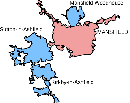
The Mansfield Urban Area is a built-up area of Nottinghamshire, England. Which comprises the towns of Mansfield, Sutton in Ashfield, and Kirkby in Ashfield. It also includes the settlement of Mansfield Woodhouse and the village of Newstead. As well as the village of New Houghton in Derbyshire. The 2011 census gives the total population of the area as 171,958 making it the 37th most populated urban area in England. The population has increased 9% from the 2001 census population of 158,114.
Excerpt from the Wikipedia article Mansfield urban area (License: CC BY-SA 3.0, Authors, Images).Mansfield urban area
Midland Way,
Geographical coordinates (GPS) Address Nearby Places Show on map
Geographical coordinates (GPS)
| Latitude | Longitude |
|---|---|
| N 53.14 ° | E -1.2 ° |
Address
Midland Way
Midland Way
NG18 1HD
England, United Kingdom
Open on Google Maps


