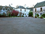
Peterculter
Areas of AberdeenPages including recorded pronunciationsUse British English from March 2017Villages in Aberdeen

Peterculter , also known as Culter, is an outer suburb of Aberdeen, Scotland, about eight miles (13 km) from the city centre. It lies on the north bank of the River Dee, at its confluence with the Culter Burn. Following the 1996 Scottish council boundary changes it became part of the Lower Deeside ward in the Aberdeen City council area.
Excerpt from the Wikipedia article Peterculter (License: CC BY-SA 3.0, Authors, Images).Peterculter
Craigton Terrace, Aberdeen City Culter
Geographical coordinates (GPS) Address Nearby Places Show on map
Geographical coordinates (GPS)
| Latitude | Longitude |
|---|---|
| N 57.097 ° | E -2.2657 ° |
Address
Craigton Terrace
Craigton Terrace
AB14 0SA Aberdeen City, Culter
Scotland, United Kingdom
Open on Google Maps


