place

Parkfield High School

1962 establishments in England2009 disestablishments in EnglandDefunct schools in WolverhamptonEducational institutions disestablished in 2009Educational institutions established in 1962
Use British English from March 2017West Midlands (county) school stubs

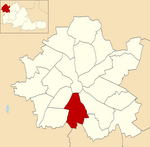
Parkfield High School was a secondary school located in Wolverhampton, West Midlands, England. Opened in April 1962, it was situated in the Parkfield area which has been administratively part of Wolverhampton since 1966, having previously been on the northern edge of the Urban District of Coseley. The school served the neighbourhoods of Lanesfield, Woodcross, and Ettingshall. It was built during the 1960s, with extensions following during the 1970s, and around 1980 the main building was extensively renovated due to mining subsidence. The school replaced the former Manor Secondary School near Woodcross, Coseley. The last headmaster before the school was succeeded by South Wolverhampton and Bilston Academy was Mr Arthur Thompson, who retired in July 2009. The two sites which Parkfields maintained joined together on the Wolverhampton Road East site from September 2009. The school closed on 31 August 2009.

Excerpt from the Wikipedia article Parkfield High School (License: CC BY-SA 3.0, Authors).

Parkfield High School
Wolverhampton Road East, Wolverhampton

Geographical coordinates (GPS) Address Phone number Website Nearby Places
placeShow on map

Wikipedia: Parkfield High SchoolContinue reading on Wikipedia

Geographical coordinates (GPS)

Latitude Longitude
N 52.56254 ° E -2.11793 °
placeShow on map

Address

The Khalsa Academy Wolverhampton

Wolverhampton Road East
WV4 6AP Wolverhampton
England, United Kingdom
mapOpen on Google Maps

Phone number

call+441902925390

Website
khalsaacademiestrust.com

linkVisit website

Share experience

Nearby Places

Beacon Hill, Sedgley

Beacon Hill in Sedgley, England, is one of the highest points in the West Midlands, at 237 metres (778 ft) above sea level. From the summit, Wolverhampton, Walsall and Birmingham are all visible, as is the Staffordshire, Shropshire and Welsh countryside to the west. The hill is so named as historically it was one in a series of prominent locations with beacons on top, where a fire would be lit as a signal during times of war or turmoil. The Sedgley beacon lies between beacons at Barr Beacon and Cannock Chase. At the highest point, a Grade II listed tower erected in 1846 by Lord Wrottesley for astronomy, stands on the site of an earlier tower, which sits on the spot of the original beacon. When the tower was climbable (today a fence restricts access as the steps inside were removed by the council to prevent access), it was often said the Bristol Channel was visible on a clear day.. However, these claims are false as the website www.viewfinderpanoramas.org shows the southern view to extend only as far as Stinchcombe Hill near Dursley, Gloucestershire. Approximately half of Beacon Hill was situated in the urban district of Coseley, which was created in 1897 from the eastern half of the old Sedgley manor. This section included the Beacon Tower.However, the local government reorganisation of 1966 (which saw the bulk of Sedgley and approximately half of Coseley incorporated into Dudley) resulted in the creation of post code districts, with all of Beacon Hill being included in the new Sedgley DY3 post code district.

All Saints, Wolverhampton

All Saints is an inner city area of Wolverhampton, West Midlands, England. It is situated immediately to the south-east of the city centre, in the city council's Ettingshall ward. The first All Saints Church and school was built in 1864 on Steelhouse Lane. The Rev. Henry Hampton of St John's Church, Wolverhampton was its first minister. The current church was designed by London architects T. Taylor Smith & G. F. Roper in the early gothic style and consecrated in 1879. A separate parish was formed two years later. The church building was extensively added to in 1892–3. The church is part of the ecclesiastical parish of Central Wolverhampton. The nave of the church has been partitioned off and is used by a community group. The former All Saints' Infants and Junior School, which opened in 1894 stands next to the church. The school closed in 1990 with pupils transferring to Grove Primary School on Caledonia Road. The school building is now known as The Workspace and operated by All Saints Action Network, a social enterprise.The neighbourhood mostly consists of late 19th century and early 20th century terraced houses, which are mainly inhabited by Sikh and Ravidassia immigrants from the Indian sub-continent. Modern landmarks in the area include, Ford and Nissan car dealerships, a bowling alley and a Fitness First public gym. The Royal Hospital, Wolverhampton, which closed in June 1997, is situated in the area.It is a fairly deprived area with high levels of crime and unemployment, with much of the housing stock in a dismal condition. As recently as the 1980s, many houses in the area were lacking bathrooms and indoor toilets. Since then, a significant number of these older properties have been demolished. Mount Zion 7th Day Church of God has a fellowship on Caledonia Road and hosts a food bank. On the same road are Grove Primary School and its neighbour, St Mary and St John's Catholic Primary Academy. Pond Lane Mission Hall, a tin tabernacle was established in 1896 in the parish of St Luke's, Blakenhall.The former premises of James Baker & Sons Ltd, boot manufacturers stands on Vicarage Road and Cleveland Road. The business started out in 1850 making industrial footwear, but later changed to boots and shoes. The factory dates from 1861 and was extended to Powlett Street in 1898. It is Grade II listed and has a courtyard plan. The firm closed in the 1970s.