Shenley Green
Areas of Birmingham, West MidlandsWest Midlands (county) geography stubs

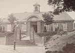
Shenley Green is an area of Birmingham. It is located in the south-west of the city, between Weoley Castle and Northfield. Shenley Green was a post war development built on the location of Shendley Green Farm and by 1958 there were around 8,000 residents. The centre of Shenley Green comprises a shopping area, the Shenley Centre and St. David's Church. It is part of Bournville Village Trust. The Shenley Green Centre was conceived by local people and built in 1965 as a youth club. St. David's Church was opened in 1970 and its prominent feature is the large lantern tower. The former church building became the community hall for the new church.
Excerpt from the Wikipedia article Shenley Green (License: CC BY-SA 3.0, Authors, Images).Shenley Green
Cornbrook Road, Birmingham
Geographical coordinates (GPS) Address Nearby Places Show on map
Geographical coordinates (GPS)
| Latitude | Longitude |
|---|---|
| N 52.426666666667 ° | E -1.9741666666667 ° |
Address
Cornbrook Road
Cornbrook Road
B29 4EP Birmingham
England, United Kingdom
Open on Google Maps


