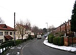
Bramley, Leeds
Places in LeedsUse British English from March 2015

Bramley is a district in west Leeds, West Yorkshire, England. It is part of the City of Leeds Ward of Bramley and Stanningley with a population of 21,334 at the 2011 Census. The area is an old industrial area with much 19th century architecture and 20th century council housing in the east and private suburban housing in the west.
Excerpt from the Wikipedia article Bramley, Leeds (License: CC BY-SA 3.0, Authors, Images).Bramley, Leeds
Upper Town Street, Leeds Bramley
Geographical coordinates (GPS) Address Nearby Places Show on map
Geographical coordinates (GPS)
| Latitude | Longitude |
|---|---|
| N 53.8124 ° | E -1.6285 ° |
Address
Upper Town Street Waterloo Lane
Upper Town Street
LS13 3JT Leeds, Bramley
England, United Kingdom
Open on Google Maps


