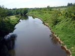
Serpentine River (British Columbia)
Metro Vancouver geography stubsRivers of the Lower MainlandSurrey, British Columbia

The Serpentine River's headwaters are in North Surrey, British Columbia. The river winds its way to its mouth at Mud Bay, off the Strait of Georgia and is extensively irrigated. It has a watershed area of 116 km2 and a total length of 35 km.The marshy Serpentine Wildlife Area ('Serpentine Fen') near where the river passes beneath King George Boulevard, is a stopping place for migratory birds, waterfowl and a variety of animals.
Excerpt from the Wikipedia article Serpentine River (British Columbia) (License: CC BY-SA 3.0, Authors, Images).Serpentine River (British Columbia)
Surrey
Geographical coordinates (GPS) Address Nearby Places Show on map
Geographical coordinates (GPS)
| Latitude | Longitude |
|---|---|
| N 49.083055555556 ° | E -122.85 ° |
Address
South Surrey
Surrey (South Surrey)
British Columbia, Canada
Open on Google Maps


