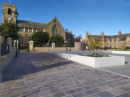
Bishopwearmouth
10th-century establishments in England930 establishmentsCity of Sunderland suburbsSunderlandTyne and Wear geography stubs

Bishopwearmouth is a former village and parish which now constitutes the west side of Sunderland City Centre, merging with the settlement as it expanded outwards in the 18th and 19th centuries. It is home to the Sunderland Minster church, which has stood at the heart of the settlement since the early Middle Ages.
Excerpt from the Wikipedia article Bishopwearmouth (License: CC BY-SA 3.0, Authors, Images).Bishopwearmouth
High Street West, Sunderland Ashbrooke
Geographical coordinates (GPS) Address Phone number Website Nearby Places Show on map
Geographical coordinates (GPS)
| Latitude | Longitude |
|---|---|
| N 54.90582 ° | E -1.388785 ° |
Address
Sunderland Minster
High Street West
SR1 3ET Sunderland, Ashbrooke
England, United Kingdom
Open on Google Maps


