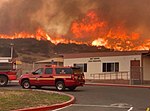
Agua Dulce, California
Census-designated places in CaliforniaCensus-designated places in Los Angeles County, CaliforniaPages including recorded pronunciationsSierra Pelona RidgeUse mdy dates from April 2024

Agua Dulce () (Spanish for "Sweet Water") is a census-designated place in Los Angeles County, California, United States. It lies at an elevation of 2,526 feet (770 m), northeast of Santa Clarita. The community had a population of 3,342 at the 2010 census and covers a geographic area of about 23 square miles (59 km2). Agua Dulce is on the Pacific Crest Trail. The ZIP code is 91390 (shared with Green Valley and far northern Santa Clarita), and the area code is 661.
Excerpt from the Wikipedia article Agua Dulce, California (License: CC BY-SA 3.0, Authors, Images).Agua Dulce, California
Telephone Road,
Geographical coordinates (GPS) Address Nearby Places Show on map
Geographical coordinates (GPS)
| Latitude | Longitude |
|---|---|
| N 34.5 ° | E -118.32 ° |
Address
Telephone Road
California, United States
Open on Google Maps


