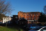
Streetly
Streetly is an area in the county of West Midlands, England which lies around 7 miles (11 km) to the north of Birmingham City Centre. It is uniquely located within the borders of Birmingham, Lichfield and Walsall district authorities, and is part of the West Midlands conurbation. It is adjacent to, New Oscott, Great Barr, Four Oaks, Little Aston and Aldridge. Streetly is a semi-rural district, lying close to many farms and is separated from Walsall by open fields and the North Birmingham green belt. The local area includes Sutton Park of which Streetly has its own dedicated gate. Streetly is part of the Birmingham Metropolitan Area and the Birmingham Urban Area. Bus services provide links to Birmingham, Walsall and Sutton Coldfield. Most are operated by National Express West Midlands. The area was served by trains on the Sutton Park Line. However while the line remains open for freight, Streetly railway station closed in 1965 and the nearest station now is in Four Oaks railway station on the opposite side of Sutton Park.
Excerpt from the Wikipedia article Streetly (License: CC BY-SA 3.0, Authors).Streetly
Chester Road,
Geographical coordinates (GPS) Address Nearby Places Show on map
Geographical coordinates (GPS)
| Latitude | Longitude |
|---|---|
| N 52.577 ° | E -1.884 ° |
Address
Nissan
Chester Road
B74 2HE
England, United Kingdom
Open on Google Maps


