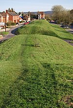
Stoborough

Stoborough () is a village in the English county of Dorset. It is situated one mile to the south of the town of Wareham, and separated from it by the River Frome. Stoborough and nearby Stoborough Green form part of the civil parish of Arne. Stoborough is a liberty, in the parish of the Holy Trinity, next to the borough of Wareham, and is ¾ of a mile South of Wareham. It has been historically governed by a mayor and bailiff, chosen at Michaelmas; appointed by a jury at the Lord's manor court. Stoborough was reputed to be the settlement from which Wareham was founded. In an 1832 administrative map of liberties and the List of Hundreds in Dorset, the boundaries of Stoborough is shown clearly as a large yellow liberty.
Excerpt from the Wikipedia article Stoborough (License: CC BY-SA 3.0, Authors, Images).Stoborough
Corfe Road,
Geographical coordinates (GPS) Address Nearby Places Show on map
Geographical coordinates (GPS)
| Latitude | Longitude |
|---|---|
| N 50.6769 ° | E -2.1094 ° |
Address
Corfe Road 31
BH20 5AG , Arne
England, United Kingdom
Open on Google Maps


