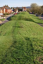
Purbeck District

Purbeck was a local government district in Dorset, England. The district was named after the Isle of Purbeck, a peninsula that forms a large proportion of the district's area. However, it extended significantly further north and west than the traditional boundary of the Isle of Purbeck which is the River Frome. The district council was based in the town of Wareham, which is itself north of the Frome. The district was formed under the Local Government Act 1972 on 1 April 1974, from the former municipal borough of Wareham, Swanage urban district and Wareham and Purbeck Rural District. The district and its council were abolished on 1 April 2019, together with the other four districts outside the greater Bournemouth area, to form a new Dorset unitary authority.Its name is recorded in 948 AD as Anglo-Saxon Purbicinga, meaning "of the people of Purbic", where Purbic may be a former Celtic name, or may contain a supposed Anglo-Saxon word *pur or "male lamb".
Excerpt from the Wikipedia article Purbeck District (License: CC BY-SA 3.0, Authors, Images).Purbeck District
North Street,
Geographical coordinates (GPS) Address Nearby Places Show on map
Geographical coordinates (GPS)
| Latitude | Longitude |
|---|---|
| N 50.686 ° | E -2.1099194444444 ° |
Address
North Street
North Street
BH20 4AW , Wareham Town
England, United Kingdom
Open on Google Maps


