place

Boxley Abbey

1140s establishments in England1540 disestablishments in EnglandBoxleyChristian monasteries established in the 12th centuryCistercian monasteries in England
Monasteries dissolved under the English ReformationMonasteries in KentReligious organizations established in the 1140sUse British English from June 2015
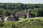
Remains of Boxley Abbey and North Downs geograph.org.uk 1101929

Boxley Abbey was a Cistercian monastery in Sandling, near Maidstone in Kent, England. It sits at the foot of the North Downs and falls within the parish of Boxley. The abbey was founded around 1146 CE by William of Ypres, leader of King Stephen of England's Flemish mercenaries, and populated by monks from Clairvaux Abbey in Ville-sous-la-Ferté, France. Its ruins can be found north of Maidstone, just northeast of the M20-A229 Sandling Interchange.

Excerpt from the Wikipedia article Boxley Abbey (License: CC BY-SA 3.0, Authors, Images).

Geographical coordinates (GPS)

Latitude Longitude
N 51.300154 ° E 0.52479 °
placeShow on map

Address


ME14 3BT , Boxley
England, United Kingdom
mapOpen on Google Maps

Remains of Boxley Abbey and North Downs geograph.org.uk 1101929
Share experience

Nearby Places

Allington Castle
Allington Castle

Allington Castle is a stone castle in Allington, Kent, just north of Maidstone, in England. The first castle on the site was an unauthorised fortification, built during "The Anarchy" (1135–1153) and torn down later in the century when royal control was reasserted. It was replaced by a manor house, which was fortified with royal permission in the 13th century. Various alterations and expansions were made by successive owners over the following two centuries. The property was developed into a fortified compound with six towers at irregular intervals along the curtain wall and domestic buildings in the interior, including one of the first long galleries built in England. In 1554 it was seized by the Crown in the course of dispossessing its owner, Sir Thomas Wyatt the Younger, after the failure of his rebellion against Queen Mary. The castle entered a state of decay that was accelerated by fires, neglect and vandalism, until it was largely ruined by the start of the 20th century. It was saved and restored by the efforts of Sir Martin Conway and his wife during the first half of the century. After nearly 50 years of occupation by a community of Carmelite friars and nuns, it returned to being a private residence in 1999 and is currently the home of Sir Robert Worcester, the founder of the MORI polling company. It is a grade I listed building and is used as a wedding venue, though there is no public access other than occasional tours involving trips from Maidstone town centre on the Kentish Lady river boat.

White Horse Stone
White Horse Stone

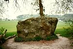
The White Horse Stone is a name given to two separate sarsen megaliths east of Blue Bell Hill, near the hamlet of Sandling and the village of Aylesford, north of Maidstone, in the south-eastern English county of Kent. The Lower White Horse Stone was destroyed prior to 1834, at which time the surviving Upper White Horse Stone took on its name and folkloric associations. Various archaeologists have suggested—although not proven—that the stones were each part of chambered long barrows constructed in the fourth millennium BC, during Britain's Early Neolithic period. If the White Horse Stones were originally components of chambered long barrows, then they would have been erected by pastoralist communities shortly after the introduction of agriculture to Britain from continental Europe. Long-barrow building was an architectural tradition widespread across Neolithic Europe although comprised various localised regional variants; one of these was in the vicinity of the River Medway, examples of which are now known as the Medway Megaliths. The White Horse Stones lie on the eastern side of the river, along with the chambered long barrows of Little Kit's Coty House, Kit's Coty House, the (now destroyed) Smythe's Megalith, and the Coffin Stone, which may be a part of a fourth. Three other examples, the Coldrum Long Barrow, Addington Long Barrow, and Chestnuts Long Barrow, remain on the western side of the river. Excavation has revealed the existence of an Early Neolithic longhouse near to the stone. By the 19th century, antiquarians were speculating that the Lower White Horse Stone may have taken its name from the White Horse of Kent, which they in turn believed was the flag of the legendary fifth-century Anglo-Saxon warriors Hengest and Horsa. Subsequent historical research has not accepted this interpretation. After the stone was destroyed, the stories associated with it were transposed to a nearby sarsen boulder, which became known as the Upper White Horse Stone. Since at least the 1980s, the latter has been viewed as a sacred site by various Folkish Heathen groups, including the Odinic Rite, because of its folkloric associations with Hengest and Horsa and the Anglo-Saxon Migration. As well as performing rituals there, they have opposed vandalism of the stone and campaigned to stop development in the vicinity.

Smythe's Megalith
Smythe's Megalith

Smythe's Megalith, also known as the Warren Farm Chamber, was a chambered long barrow east of Blue Bell Hill, north of Maidstone, in the south-eastern English county of Kent, close to Aylesford village and the hamlet of Sandling. Probably constructed in the 4th millennium BCE, during Britain's Early Neolithic period, it was discovered in 1822, at which point it was dismantled. Built out of earth and at least five local sarsen megaliths, the long barrow consisted of a roughly rectangular earthen tumulus with a stone chamber in its eastern end. Human remains were deposited into this chamber. Archaeologists have established that the monument was built by pastoralist communities shortly after the introduction of agriculture to Britain from continental Europe. Although representing part of an architectural tradition of long barrow building widespread across Neolithic Europe, Smythe's Megalith belonged to a localised regional variant produced in the vicinity of the River Medway, now known as the Medway Megaliths. Several of the Medway Megaliths still survive: Coldrum Long Barrow, Addington Long Barrow, and Chestnuts Long Barrow are on the river's western side, while Kit's Coty House, the Little Kit's Coty House, and the Coffin Stone are on the eastern side nearer to Smythe's Megalith. Close to the site of the lost monument is the White Horse Stone, a standing stone that may have once been part of another chambered long barrow. The site may have been ransacked during the Middle Ages, as other Medway Megaliths were. By the early 19th century it was buried beneath soil, largely due to millennia of hillwash coming down from the adjacent Blue Bell Hill. In 1822, it was discovered by farm labourers ploughing the land; the local antiquarians Clement Smythe and Thomas Charles were called in to examine it. Shortly after, the labourers pulled away the stones and dispersed most of the human remains, destroying the monument. Smythe and Charles produced, but did not publish, reports on their findings, and these have been discussed by archaeologists since the mid-20th century.