Ingleby Barwick

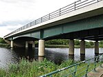
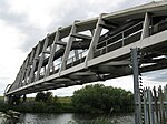
Ingleby Barwick is a town and civil parish in the Borough of Stockton-on-Tees, North Yorkshire, England. It is south of the River Tees and north-east of the River Leven. Large scale development of the town started in the late 1970s on farm land south-west of Thornaby, the first development being officially opened on 30 July 1981 by the mayor of Langbaurgh. At a parish council meeting in February 2007, the parish gained town status in with the passing of a resolution under the Local Government Act 1972 s245(6).In 2011, the population of the civil parish of Ingleby Barwick was 20,378, its two electoral wards (which also include the settlements of Hilton, Maltby, High Leven and Low Leven) had a population of 21,045.
Excerpt from the Wikipedia article Ingleby Barwick (License: CC BY-SA 3.0, Authors, Images).Ingleby Barwick
Morville Court,
Geographical coordinates (GPS) Address Nearby Places Show on map
Geographical coordinates (GPS)
| Latitude | Longitude |
|---|---|
| N 54.519 ° | E -1.311 ° |
Address
Morville Court
Morville Court
TS17 0XY
England, United Kingdom
Open on Google Maps


