place

Szlachtowa Ruthenia

East Slavic history stubsEthnic enclaves in EuropeLemkosNowy Targ CountyPoland geography stubs
Regions of Poland
Jaworki a1
Jaworki a1

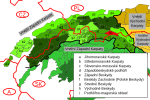
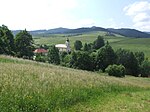
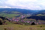
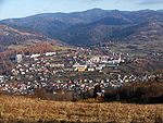
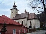
Ruś Szlachtowska (Shlakhtov Ruthenia) was a name introduced in 1930s by Prof. Roman Reinfuss to denote the region surrounding the villages of Biała and Czarna Woda, Jaworki, and Szlachtowa in the Grajcarek valley in the Pieniny mountains, in the Nowy Targ County of southern Poland. The region was the westernmost area inhabited by Lemkos. It was separated from the rest of the Lemko Region by the Polish-dominated Poprad valley which led to isolation of the local population and its gradual assimilation with Poles and Slovaks, until Operation Vistula in 1947, when the Lemkos were deported together with Ukrainians to other areas of Poland and to the Soviet Union. Since then, the villages of Jaworki and Szlachtowa were gradually settled by Polish population from Podhale and Spisz, and the remaining two villages do not exist today. It is not known for certain when the first settlers arrived in the valley, but it was probably not before the 15th century because Jan Długosz states nothing about the settlement in his Liber beneficiorum.

Excerpt from the Wikipedia article Szlachtowa Ruthenia (License: CC BY-SA 3.0, Authors, Images).

Szlachtowa Ruthenia
Pod Homolami, gmina Szczawnica

Geographical coordinates (GPS) Address Nearby Places
placeShow on map

Wikipedia: Szlachtowa RutheniaContinue reading on Wikipedia

Geographical coordinates (GPS)

Latitude Longitude
N 49.410027 ° E 20.542932 °
placeShow on map

Address

Pod Homolami 1
34-460 gmina Szczawnica
Lesser Poland Voivodeship, Poland
mapOpen on Google Maps

Jaworki a1
Jaworki a1
Share experience

Nearby Places

Pieniny
Pieniny

The Pieniny (sometimes also the Pienins or the Pienin Mountains, Hungarian: Pieninek) is a mountain range in the south of Poland and the north of Slovakia. It is classified within the eastern section of the Western Beskids. The Pieniny mountain range is divided into three parts – Pieniny Spiskie (Slovak: Spišské Pieniny) and Pieniny Właściwe (Slovak: Centrálne Pieniny) in Poland; and, Małe Pieniny (English: Lesser or Little Pieniny; Slovak: Malé Pieniny) in Poland and Slovakia. The Pieniny mountains consist mainly of beds of limestone and dolomite. The most famous peak, Trzy Korony (Three Crowns), is 982 metres high. It is also the summit of the Three Crowns Massif. Pieniny's highest peak – Wysoka (Polish); Vysoké Skalky (Slovak) – reaches 1,050 metres above sea level. Pieniny mountains formed at the bottom of the sea in several geological epochs. They were folded and raised in Upper Cretaceous. At the beginning of the Paleogene geologic period a second wave of tectonic movements took place causing a further shift. The third wave of movements during the Paleogene and Neogene resulted in a more complex tectonic structure. At the same time erosion resulted in stripping of the outer mantle rocks and further modeling of terrain. Peaks were built from weather resistant Jurassic rocks, mainly limestone. Valleys and passes were created from softer and more susceptible to weathering rocks of Cretaceous and Paleogene periods. Caves are few and rather small. By contrast, rivers and streams are often deeply indented in the rock, creating approximately 15 ravines and gorges. The most famous gorges of the Pieniny mountains are the Dunajec River Gorge in Pieniny National Park and the Homole Ravine (Polish: Wąwóz Homole). Hills along the northern border of Pieniny are of volcanic origin.

Kotuńka
Kotuńka

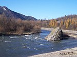
The Kotuńka Rock is a prominent rock found in the centre of the current of the river Dunajec just before the entry into Szczawnica. Built from limestone, the rock is well seen from the road and is a characteristic landmark in the area. Just above the rock the Grajcarek flows into the Dunajec. On from the rock is a bridge, after which begins the Pieniny Trail Road which heads to a border crossing. Around the Kotuńka rock the Dunajec river rapid is very strong and creates a swirl. This water feature is used by mountain kayakers, which often train in the area, to the left of the Kotuńka rock are embedded gates for such activities. As with many Pieniny rocks, the Kotuńka rock also has a legend. According to the legend, the devil carried a rock which he tried to bring to the Pieniny Castle on the Castle Mountain in the Pieniny, before which in the Tatra Mountains Kinga of Poland was hiding in. However along the way a rooster crowed and the devil's energy went away. The rock fell from the devil's hands and tumbled down into the river without getting anybody hurt. This is the most famous of the legends about the rock. Kotuńka rock has a height of 9.5 metres, and the tip of the rock is situated at a height of 438 metres. In the years 1875 to 1912 there was a sculpture of a Goral, which welcomed visitors heading to Szczawnica, in the year 1997 a similar statue was placed. Jadwiga Łuszczewska in the year 1869 wrote "we call it Kotuńka rock, because it creeps out of the water, like a sly cat lurking".