place

Grajcarek

Rivers of Lesser Poland VoivodeshipRivers of PolandTributaries of the Dunajec
Grajcarek a1
Grajcarek a1

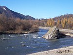
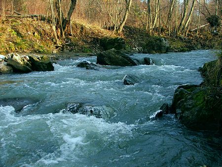
Grajcarek is a minor river, a stream, running between foothills of the Lesser Pieniny and Beskid Sądecki. It starts at Jaworki, as the confluence of the Biała Woda and Czarna Woda streams. The river flows through Jaworki, Szlachtowa, and flows into the Dunajec in Szczawnica, just before the characteristic Kotuńka Rock, at an elevation of 430 metres. After the crossroads of the roads is a bridge, under which flows the river Grajcarek, after which the Pieniny Trail Road begins.The source of Grajcarek are considered to be at the source of Biała Woda, which is found at a height of approximately 950 metres. The basin area of the river is 85,5 km², the length from the source to the mouth of the river is about 15 km, with an average fall of 3.5%. The river flows in the general direction of East to the West of the valley, which is also the border between the Pieniny and Beskid Sądecki. Formerly Grajcarek was called Ruski Potok which can be translated as Ruthenian Stream (before Operation Vistula when the villages which were located around the river Szlachtowa, Jaworki, Biała Woda and Czarna Woda were inhabited by Lemkos, see Ruś Szlachtowska). The name of the river Grajcarek was given by tourists and bathers at the end of the 19th century.

Excerpt from the Wikipedia article Grajcarek (License: CC BY-SA 3.0, Authors, Images).

Grajcarek
Most Flisaków, gmina Szczawnica

Geographical coordinates (GPS) Address Nearby Places
placeShow on map

Wikipedia: GrajcarekContinue reading on Wikipedia

Geographical coordinates (GPS)

Latitude Longitude
N 49.4242 ° E 20.4593 °
placeShow on map

Address

Most Flisaków

Most Flisaków
34-460 gmina Szczawnica
Lesser Poland Voivodeship, Poland
mapOpen on Google Maps

Grajcarek a1
Grajcarek a1
Share experience

Nearby Places

Kotuńka
Kotuńka

The Kotuńka Rock is a prominent rock found in the centre of the current of the river Dunajec just before the entry into Szczawnica. Built from limestone, the rock is well seen from the road and is a characteristic landmark in the area. Just above the rock the Grajcarek flows into the Dunajec. On from the rock is a bridge, after which begins the Pieniny Trail Road which heads to a border crossing. Around the Kotuńka rock the Dunajec river rapid is very strong and creates a swirl. This water feature is used by mountain kayakers, which often train in the area, to the left of the Kotuńka rock are embedded gates for such activities. As with many Pieniny rocks, the Kotuńka rock also has a legend. According to the legend, the devil carried a rock which he tried to bring to the Pieniny Castle on the Castle Mountain in the Pieniny, before which in the Tatra Mountains Kinga of Poland was hiding in. However along the way a rooster crowed and the devil's energy went away. The rock fell from the devil's hands and tumbled down into the river without getting anybody hurt. This is the most famous of the legends about the rock. Kotuńka rock has a height of 9.5 metres, and the tip of the rock is situated at a height of 438 metres. In the years 1875 to 1912 there was a sculpture of a Goral, which welcomed visitors heading to Szczawnica, in the year 1997 a similar statue was placed. Jadwiga Łuszczewska in the year 1869 wrote "we call it Kotuńka rock, because it creeps out of the water, like a sly cat lurking".