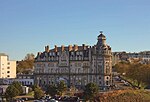
Millbay
EngvarB from September 2013Geography of Plymouth, DevonIndustrial archaeological sites in DevonPorts and harbours of DevonPorts and harbours of the English Channel

Millbay, also known as Millbay Docks, is an area of dockland in Plymouth, Devon, England. It lies south of Union Street, between West Hoe in the east and Stonehouse in the west. The area is currently subject to a public-private regeneration creating new homes, business premises, marina, a 1000-pupil school and opening up the waterfront to greater public access.
Excerpt from the Wikipedia article Millbay (License: CC BY-SA 3.0, Authors, Images).Millbay
Citadel Road, Plymouth Millbay
Geographical coordinates (GPS) Address Phone number Website Nearby Places Show on map
Geographical coordinates (GPS)
| Latitude | Longitude |
|---|---|
| N 50.368 ° | E -4.148 ° |
Address
St Andrew's CofE Primary School
Citadel Road
PL1 3AY Plymouth, Millbay
England, United Kingdom
Open on Google Maps


