place

English Stones

Gloucestershire geography stubsLandforms of GloucestershireRiver SevernRock formations of EnglandUnited Kingdom geology stubs
Use British English from December 2016
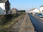
Severn Beach MMB 31 Second Severn Crossing

The English Stones are a rocky outcrop in the Severn Estuary between Caldicot, Monmouthshire, and Severn Beach, South Gloucestershire. Because the area is exposed at low tide, and is a rare spot of solid land in the highly tidal estuary, it has long been considered a good location to build barrages, dams or bridges. In the 1990s the construction of the Second Severn Crossing made use of the English Stones as a foundation for significant sections of the bridge.

Excerpt from the Wikipedia article English Stones (License: CC BY-SA 3.0, Authors, Images).

English Stones
Prince of Wales Bridge,

Geographical coordinates (GPS) Address Nearby Places
placeShow on map

Wikipedia: English StonesContinue reading on Wikipedia

Geographical coordinates (GPS)

Latitude Longitude
N 51.56636 ° E -2.68669 °
placeShow on map

Address

The Bull

Prince of Wales Bridge
BS35 4NQ , Pilning and Severn Beach
England, United Kingdom
mapOpen on Google Maps

Severn Beach MMB 31 Second Severn Crossing
Share experience

Nearby Places

Severn Tunnel
Severn Tunnel

The Severn Tunnel (Welsh: Twnnel Hafren) is a railway tunnel in the United Kingdom, linking South Gloucestershire in the west of England to Monmouthshire in south Wales under the estuary of the River Severn. It was constructed by the Great Western Railway (GWR) between 1873 and 1886 for the purpose of dramatically shortening the journey times of their trains, passenger and goods alike, between South Wales and Western England. It has often been regarded as the crowning achievement of GWR's chief engineer Sir John Hawkshaw.Prior to the tunnel's construction, lengthy detours were necessary for all traffic between South Wales and Western England, which either used ship or a lengthy diversion upriver via Gloucester. Recognising the value of such a tunnel, the GWR sought its development, tasking Hawkshaw with its design and later contracting the civil engineer Thomas A. Walker to undertake its construction, which commenced in March 1873. Work proceeded smoothly until October 1879, at which point significant flooding of the tunnel occurred from what is now known as “The Great Spring”. Through strenuous and innovative efforts, the flooding was contained and work was able to continue, albeit with a great emphasis on drainage. Structurally completed during 1885, the first passenger train was run through the tunnel on 1 December 1886, nearly 14 years after the commencement of work. Following its opening, the tunnel quickly formed a key element of the main trunk railway line between southern England and South Wales. Amongst other services, the GWR operated a car shuttle train service through the tunnel for many decades. However, the tunnel has also presented especially difficult conditions, both operationally and in terms of infrastructure and structural maintenance. On average, around 50 million litres of water per day infiltrates the tunnel, necessitating the permanent operation of several large pumping engines. Originally, during much of the steam era, a large number of pilot and banking locomotives were required to assist heavy trains traverse the challenging gradients of the tunnel, which were deployed from nearby marshalling yards. The tunnel is 7,008 m (4.355 mi) long, although only 3,621 m (2.250 mi) of its length are under the river. It was the longest underwater tunnel in the world until 1987 and, for more than 100 years, it was the longest mainline railway tunnel within the UK. It was finally exceeded in this capacity during 2007 with the opening of the two major tunnels of High Speed 1, forming a part of the Channel Tunnel Rail Link. In 2016, overhead line equipment (OHLE) was installed in the tunnel to allow the passage of electric traction; this work was undertaken as one element of the wider 21st-century modernisation of the Great Western main line.

Second Severn Crossing

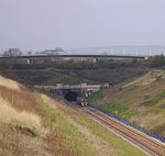
The Second Severn Crossing (Welsh: Ail Groesfan Hafren), officially named the Prince of Wales Bridge (Welsh: Pont Tywysog Cymru) since July 2018, is the M4 motorway bridge over the River Severn between England and Wales, opened in 1996 to supplement the traffic capacity of the Severn Bridge built in 1966. The bridge is operated by England's National Highways. It has a total length of 5,128 metres (16,824 ft). It is southwest of the Severn Bridge and because it is more closely in line with the rest of the M4, it reduces the length of the journey between England and Wales. The junctions at each end are designed for most traffic to use this crossing, and in order to use the old Severn Bridge, one has to leave the M4 at junction 21 and join the M48 near Aust or at junction 23 near Magor. The new crossing carries more traffic than the Severn Bridge, which is still in use. It is wider than the Severn Bridge, having three lanes and a narrow hard shoulder each way, compared to the two lanes, cycle path and narrow footpath of the original crossing. It is a cable-stayed bridge, whereas the Severn Bridge is a suspension bridge. The position of the bridge is close to that of the Severn Tunnel, which has carried the railway line beneath the river bed since 1886. Much of the estuary is mudflats at low tide, but at high tide these can be covered by as much as 14 metres (46 ft) of water. This presented the engineers with a constraint: packets of work were scheduled at low tide, and needed to be completed within the short windows allowed by the tides. The concession given to the consortium which financed, built and operate the bridge required them to take over the outstanding debt on the original Severn Bridge and to operate the two bridges as a single entity. Tolls were set annually by the government based on the previous year's change in the Retail Price Index. On the expiry of the concession in January 2018, the consortium was required to hand the bridge over to public ownership. The tolls on both bridges were subsequently scrapped in December 2018.

New Passage Pier railway station

New Passage Pier was the original terminus of the Bristol and South Wales Union Railway, located on the south bank of the River Severn at New Passage, South Gloucestershire, England. At New Passage, passengers would disembark from trains and use a boat across the Severn. New Passage had been the site of a ferry from England to Wales including the use by mail and passenger coaches between Bristol and to Portskewett in south Wales. In 1825 the New Passage Association formed, using the 30-ton steamboat "St Pierre". However, the sponsorship by the Dukes of Beaufort of the Aust route, with faster boats and a pier, meant that by 1830 mail coaches were diverted there, and the New Passage declined.Construction of the new railway started in 1858 and the single-track 7 ft (2,134 mm) broad gauge line opened from South Wales Junction, half a mile east of Bristol Temple Meads, as far as the landward end of New Passage Pier on 8 September 1863, a distance of 11 miles (18 km). The distance by rail between Bristol and Cardiff was reduced from 94 miles (151 km) to 38 miles (61 km). The Bristol and South Wales Union Railway built new piers for the ferry, that at New Passage being 546 yards (499 m) long.A steam ferry, the Saint Pierre had been built by Pride and Williams for the New Passage crossing in 1825 and it worked there until 1831. The B&SWUR bought a new steamer, the Gem in 1863 but it proved unsuitable and was soon replaced by the Relief. John Bland, a carrier and shareholder in the railway, was contracted to operate the ferry. The next vessel purchased was the Dragon Fly, this had been used by the contractors to build the piers but was too small to work as the ferry. Instead, two paddle tugs, the Ajax and the Atlas were hired in to cover for the Relief.A new paddle steamer arrived in June 1864, named Christopher Thomas after the chairman of the B&SWUR, it had been built for the company by Henderson, Coulborn and Company at Renfrew in Scotland. A slightly larger vessel named the Chepstow arrived from the same shipyard on 11 February 1875. These two continued in service until the Severn Tunnel was opened in 1886. They were sold to WS Ogden at Cardiff in 1880, the Chepstow being renamed the Rover. The funnels were generally painted black with a red band.The station became redundant in 1886 following construction of the Severn Tunnel, and was closed. The pier was demolished by 1888. A plaque now marks the site, and although the building of new piling for flood defences and new concrete castings mean there is little to no trace of the railway on the land side, at low water, some remains of wooden piling can be seen below the plaque site.

Seabank Power Station

Seabank Power Station is a 1,140 MW gas-fired power station at Hallen Marsh in Bristol, England. It is situated beside the A403 road and Severn Estuary, just north of Avonmouth and south of Severn Beach, close to the boundary with South Gloucestershire. It is next to the former Terra Nitrogen Severnside fertiliser works, which was closed by Growhow UK in January 2008.The £435 million plant is run as Seabank Power Ltd. The initial partners in the company were BG Group (former part of British Gas) and Scottish and Southern Energy (SSE), however in 2010 BG Group, as part of its reorganisation sold its 50% share of the plant to Cheung Kong Infrastructure Holdings Limited The company is now owned by Cheung Kong Infrastructure Holdings Limited, and SSE. It was built by Siemens Power Generation and initially opened in 2000. It was built in two parts, with Seabank 1 (755 MW) started in January 1996 and completed in March 2000. Seabank 2 (385 MW) was started in January 1999 and was completed in January 2001. The station has a number of step up transformers that allow connection to the National Grid high voltage electricity transmission system via the Seabank 400 kV GIS substation. The power plant provides enough electricity for approximately 1.6 million people.Seabank is a Combined cycle gas turbine (CCGT) type power station that runs on natural gas. The Gas is supplied to the station via the company's own 74-bar 42-inch (1,100 mm) pipeline that runs from a gas compressor station near Abson in Pucklechurch, Bristol through South Gloucestershire to the station. The station can also utilise the local gas connection, that was used to connect the previous Seabank Naptha/Gas Cracking station that occupied the site prior to the power station. The section first built consists of two Siemens V94.3A gas turbines with two heat recovery steam generators (HRSG) and a steam turbine. The next built section consists of one V94.3A gas turbine, an HRSG and a steam turbine. It has a 55% thermal efficiency. The HRSGs were built by Standard Fasel Lentjes (known as SFL and now owned by NEM Energy) and Stork Power Services, both Dutch companies.