place

Sudbrook, Monmouthshire

Populated places on the River SevernVillages in Monmouthshire
Sudbrook
Sudbrook

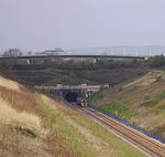
Sudbrook is a village in Monmouthshire, south east Wales. It is located 4 miles south west of Chepstow and 1 mile east of Caldicot. It lies close to the Second Severn Crossing on the Severn Estuary, and adjoins the village of Portskewett. It was largely built in the late 19th century for workers on the Severn railway tunnel. At that time it was also known as Southbrook.

Excerpt from the Wikipedia article Sudbrook, Monmouthshire (License: CC BY-SA 3.0, Authors, Images).

Sudbrook, Monmouthshire
Camp Road,

Geographical coordinates (GPS) Address Nearby Places
placeShow on map

Wikipedia: Sudbrook, MonmouthshireContinue reading on Wikipedia

Geographical coordinates (GPS)

Latitude Longitude
N 51.5818 ° E -2.7157 °
placeShow on map

Address

Sudbrook hill fort

Camp Road
NP26 5TE , Portskewett
Wales, United Kingdom
mapOpen on Google Maps

Sudbrook
Sudbrook
Share experience

Nearby Places

Second Severn Crossing

The Second Severn Crossing (Welsh: Ail Groesfan Hafren), officially named the Prince of Wales Bridge (Welsh: Pont Tywysog Cymru) since July 2018, is the M4 motorway bridge over the River Severn between England and Wales, opened in 1996 to supplement the traffic capacity of the Severn Bridge built in 1966. The bridge is operated by England's National Highways. It has a total length of 5,128 metres (16,824 ft). It is southwest of the Severn Bridge and because it is more closely in line with the rest of the M4, it reduces the length of the journey between England and Wales. The junctions at each end are designed for most traffic to use this crossing, and in order to use the old Severn Bridge, one has to leave the M4 at junction 21 and join the M48 near Aust or at junction 23 near Magor. The new crossing carries more traffic than the Severn Bridge, which is still in use. It is wider than the Severn Bridge, having three lanes and a narrow hard shoulder each way, compared to the two lanes, cycle path and narrow footpath of the original crossing. It is a cable-stayed bridge, whereas the Severn Bridge is a suspension bridge. The position of the bridge is close to that of the Severn Tunnel, which has carried the railway line beneath the river bed since 1886. Much of the estuary is mudflats at low tide, but at high tide these can be covered by as much as 14 metres (46 ft) of water. This presented the engineers with a constraint: packets of work were scheduled at low tide, and needed to be completed within the short windows allowed by the tides. The concession given to the consortium which financed, built and operate the bridge required them to take over the outstanding debt on the original Severn Bridge and to operate the two bridges as a single entity. Tolls were set annually by the government based on the previous year's change in the Retail Price Index. On the expiry of the concession in January 2018, the consortium was required to hand the bridge over to public ownership. The tolls on both bridges were subsequently scrapped in December 2018.

Severn Tunnel
Severn Tunnel

The Severn Tunnel (Welsh: Twnnel Hafren) is a railway tunnel in the United Kingdom, linking South Gloucestershire in the west of England to Monmouthshire in south Wales under the estuary of the River Severn. It was constructed by the Great Western Railway (GWR) between 1873 and 1886 for the purpose of dramatically shortening the journey times of their trains, passenger and goods alike, between South Wales and Western England. It has often been regarded as the crowning achievement of GWR's chief engineer Sir John Hawkshaw.Prior to the tunnel's construction, lengthy detours were necessary for all traffic between South Wales and Western England, which either used ship or a lengthy diversion upriver via Gloucester. Recognising the value of such a tunnel, the GWR sought its development, tasking Hawkshaw with its design and later contracting the civil engineer Thomas A. Walker to undertake its construction, which commenced in March 1873. Work proceeded smoothly until October 1879, at which point significant flooding of the tunnel occurred from what is now known as “The Great Spring”. Through strenuous and innovative efforts, the flooding was contained and work was able to continue, albeit with a great emphasis on drainage. Structurally completed during 1885, the first passenger train was run through the tunnel on 1 December 1886, nearly 14 years after the commencement of work. Following its opening, the tunnel quickly formed a key element of the main trunk railway line between southern England and South Wales. Amongst other services, the GWR operated a car shuttle train service through the tunnel for many decades. However, the tunnel has also presented especially difficult conditions, both operationally and in terms of infrastructure and structural maintenance. On average, around 50 million litres of water per day infiltrates the tunnel, necessitating the permanent operation of several large pumping engines. Originally, during much of the steam era, a large number of pilot and banking locomotives were required to assist heavy trains traverse the challenging gradients of the tunnel, which were deployed from nearby marshalling yards. The tunnel is 7,008 m (4.355 mi) long, although only 3,621 m (2.250 mi) of its length are under the river. It was the longest underwater tunnel in the world until 1987 and, for more than 100 years, it was the longest mainline railway tunnel within the UK. It was finally exceeded in this capacity during 2007 with the opening of the two major tunnels of High Speed 1, forming a part of the Channel Tunnel Rail Link. In 2016, overhead line equipment (OHLE) was installed in the tunnel to allow the passage of electric traction; this work was undertaken as one element of the wider 21st-century modernisation of the Great Western main line.