place

1866 great fire of Portland, Maine
1860s fires in the United States1866 disasters in the United States1866 fires1866 in Maine19th century in Portland, Maine
Firefighting in Portland, MaineFires in MaineJuly 1866 eventsNatural disasters in MaineOld Port of Portland, MaineUrban fires in the United States
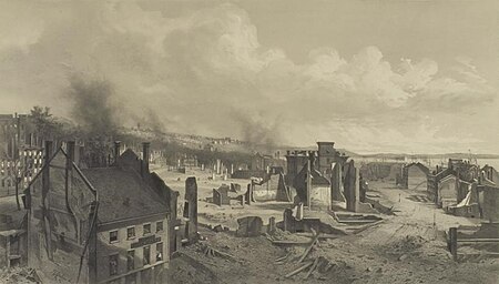
Ruins of the Great Fire at Portland, ME

The great fire of Portland, Maine, sometimes known as the 1866 great fire of Portland, occurred on July 4, 1866—the second Independence Day after the end of the American Civil War. Five years before the Great Chicago Fire, this was the greatest fire yet seen in an American city. It started in a boat house on Commercial Street, likely caused by a firecracker or a cigar ash. The fire spread to a lumber yard and on to a sugar house, then spread across the city, eventually burning out on Munjoy Hill in the city's east end. Two people died in the fire and 10,000 people were made homeless. 1,800 buildings were burned to the ground. This included the federal Exchange Building by which was replaced with the custom house. Soon after the fire, Portland native and acclaimed poet Henry Wadsworth Longfellow described his old home town: "Desolation, desolation, desolation. It reminded me of Pompeii, that ‘sepult city."

Excerpt from the Wikipedia article 1866 great fire of Portland, Maine (License: CC BY-SA 3.0, Authors, Images).

1866 great fire of Portland, Maine
Rue Rémy Delanghe, Lens

Geographical coordinates (GPS) Address Nearby Places
placeShow on map

Wikipedia: 1866 great fire of Portland, MaineContinue reading on Wikipedia

Geographical coordinates (GPS)

Latitude Longitude
N 43.651388888889 ° E -70.256944444444 °
placeShow on map

Address

Rue Rémy Delanghe

Rue Rémy Delanghe
62880 Lens
Nordfrankreich, Frankreich
mapOpen on Google Maps

Ruins of the Great Fire at Portland, ME
Share experience

Nearby Places

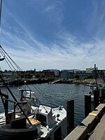
Commercial Street, Portland, Maine

Commercial Street is a downtown street in the Old Port of Portland, Maine, United States. It is part of U.S. Route 1A. It became the Old Port's waterfront in the early 20th century, replacing Fore Street, after land was reclaimed from the waters of Casco Bay and the Fore River.In 2008, it was named one of the ten best streets in the United States by the American Planning Association. Built upon old piers in the 1850s, fill was pushed into Casco Bay to accommodate the growing railroad and warehousing needs of the port's working waterfront. In the 1970s and 1980s, much of the economic activity on the street was hurt and many of the properties on the street were sold off for non-marine development, including the building of condominiums. In 1987, Portland voters, led by local fisherman based on Commercial Street, halted all non-marine development along the street and adjacent docks. Marine development around Commercial Street returned in the 1990s and 2000s (decade) alongside other economic development, including tourism-related industries.The Maine State Pier, a deepwater marine facility and outdoor music venue, is located at the intersection of Commercial Street and Franklin Street. The Portland Star Match Factory, located at 65-89 West Commercial Street near the West End. The street, which was originally known as Thames Street, becomes West Commercial Street from beneath the Casco Bay Bridge heading west. Thames Street still exists from India Street heading northeast, eventually merging into footpaths beneath the Eastern Promenade.